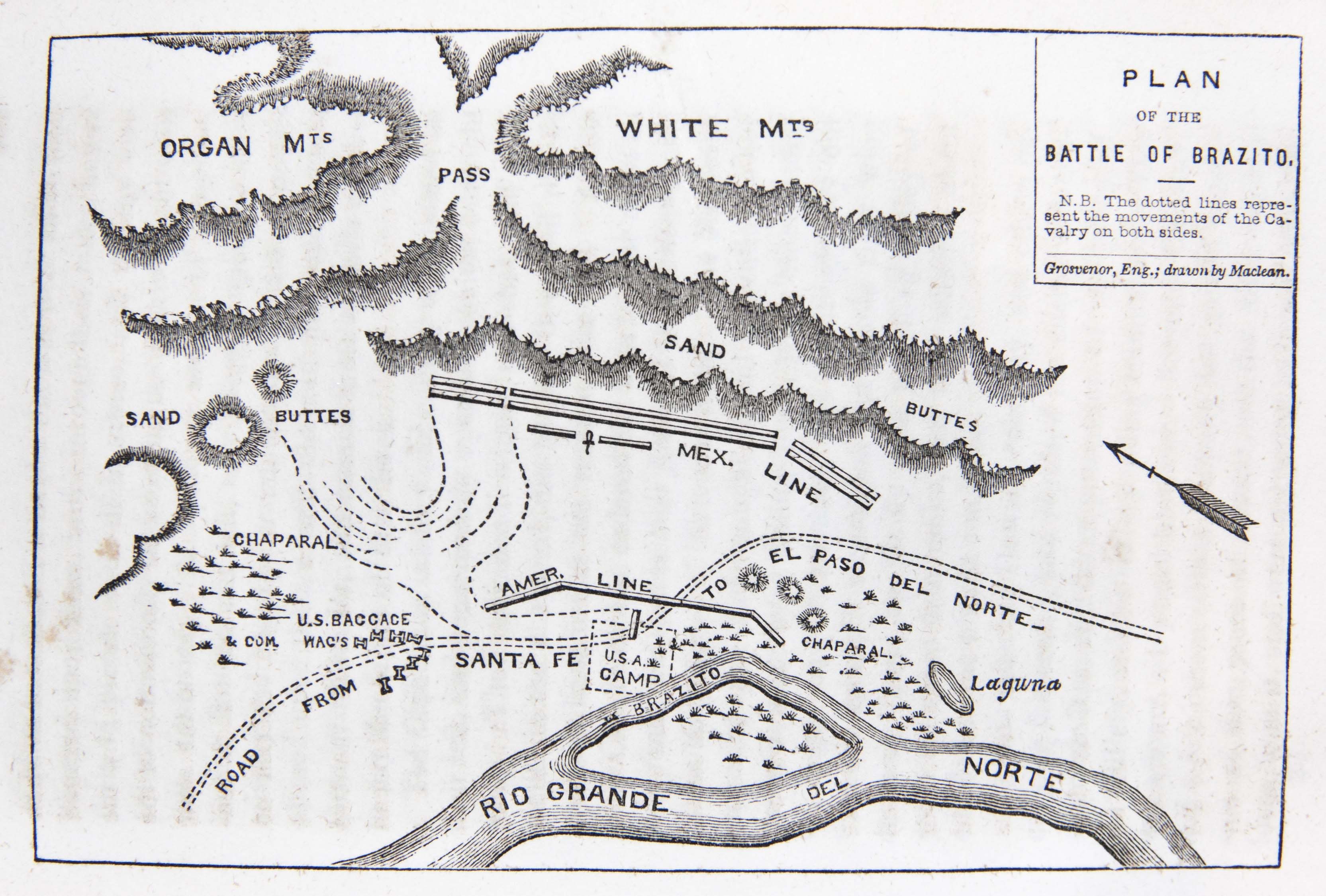
Brazito or Temascolitos was located on the Rio Grande about 30 miles north of the Mexican town El Paso (now known as Juarez). At Brazito on December 25, 1846, Colonel Alexander Doniphan and his Missouri Volunteers engaged a Mexican force under Major Antonio Ponce de Leon. After the Mexicans withdrew, Doniphan and his men occupied El Paso (today's Juarez). The plan was originally drawn by Missouri Volunteer L.A. MacLean.
Date: 1846-12-25 1848-00-00
Format: maps
Publisher and Date Published: J.A. & U.P. James 1848-00-00
Language: English
Publication Place: Cincinnati (Ohio)
Contributor:
Grosvenor
Creator:
MacLean, Lachlan Allan
Collection: Garrett Bay D
Call Number: E405.2 .H88
Source Title: Doniphan's expedition; containing an account of the conquest of New Mexico; General Kearney's overland expedition to California; Doniphan's campaign against the Navajos; his unparalleled march upon Chihuahua and Durango; and the operations of General Price at Santa Fe?: with a sketch of the life of Col. Doniphan ... By John T. Hughes ...

