
by Evan Spencer
by Evan Spencer
The purpose of The Compass Rose is to raise awareness of Special Collections' resources and to foster the use of these resources. The blog series also reports significant new programs, initiatives, and acquisitions of Special Collections.
Today, Special Collections presents a special guest post from Anthropology undergraduate student Ashlei Jones. She reflects upon historic French maps and how they made her reconsider her early education about Africa. Ashlei developed this post as part of Art of Sub-Saharan Africa class explorations of the Searching for Africa exhibition in Special Collections. View blog posts from Ashlei's classmates, Deb Vickery and Rebeca Compean-Serrano.
The Searching for Africa exhibition at the UTA Libraries Special Collections allowed me to travel back in time, both to my childhood and to the period known today as the “Scramble for Africa” (circa 1884-1914). During this time (and following the abolition of slavery in most areas of the world), many European governments “scrambled” in competition with others to take control of African lands and natural resources. This ended in almost the entire continent of Africa coming under colonial control of European powers.
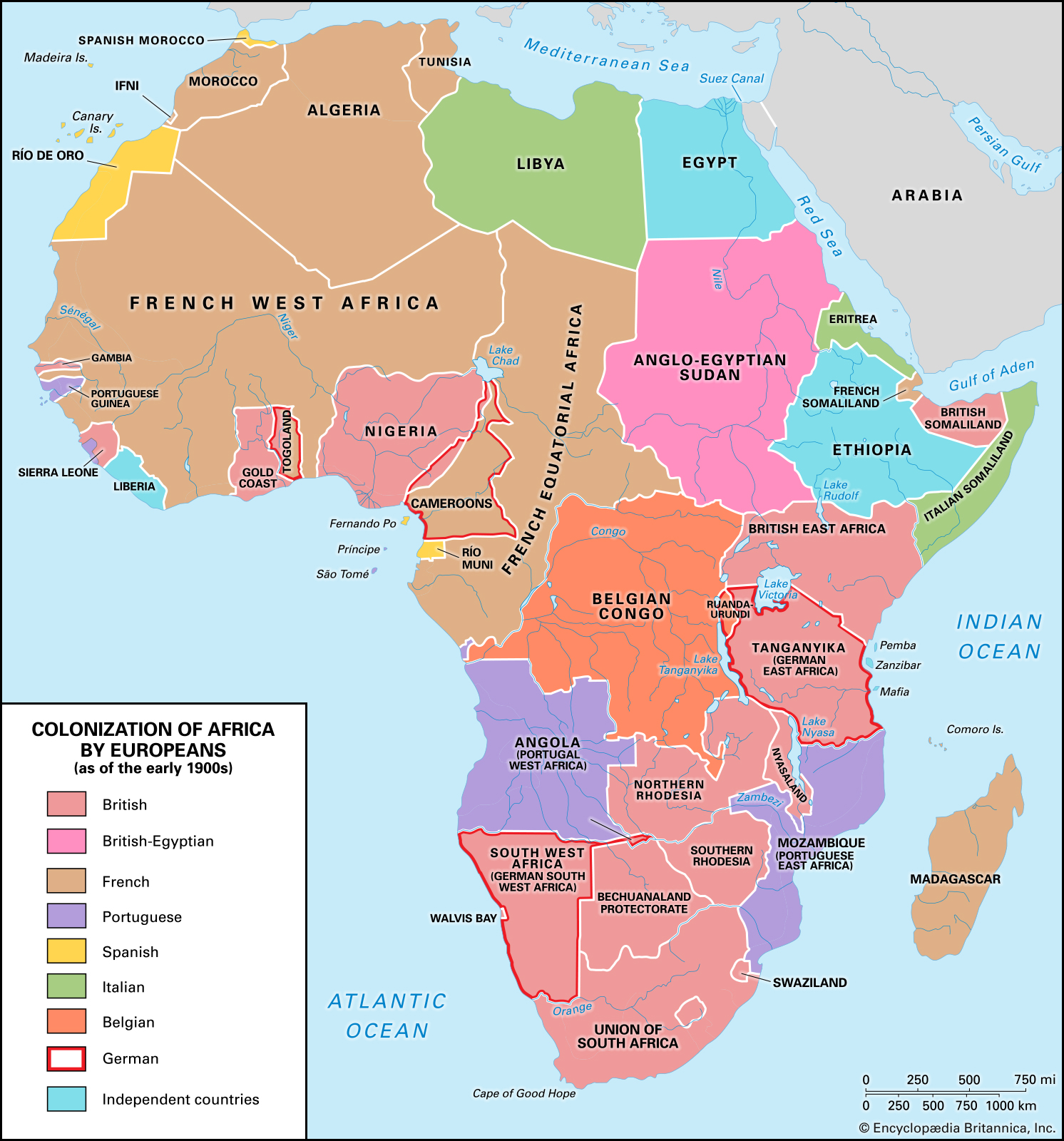
Like many American schoolchildren, I learned about this period through maps like that in Figure 1, an image created for children that depicts the history of African colonialism . This map and others like it are often used in K-12 history and social studies classes to illustrate the colonial landscape across the African continent. With bright colors and simple word choices, such maps offer a sterilized view of African colonization, a political and economic process that is often difficult to discuss with young children. These sanitized, “child-friendly,” and even attractive images give a false sense of security to the pleasant narratives of history that Europeans and Euro-Americans have written.
For example, the large orange area labeled “Belgian Congo” in Figure 1 offers no indication of the tragic loss of millions of Congolese lives (Twain 1905) when that region was Belgian King Leopold II’s personally-owned colony, called the Congo Free State, from 1885 to 1908 (Senelle and Clement 2009). By 1899, writers and activists were exposing the atrocities undertaken by colonial administrators of the rubber industry there, including the dismemberment of children when their parents could not fulfill quotas for rubber collection (Alexander 2019). Activist Alice Seeley Harris lived in the Congo Free State and documented these human rights violations. One of her photographs, Father stares at the severed hands of his five year-old daughter (not pictured here due to its graphic nature but accessible via this link), tragically illustrates the fate of a child and her family as “subjects” of the Congo Free State (Sliwinski 2006).
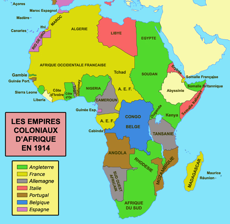
In 1908, the Belgian government seized those lands from King Leopold II’s personal possession and created the so-called “Belgian Congo” as a formal colony under the jurisdication of the Belgian Parliament. Maps like Figure 1 do nothing to indicate such histories. Futhermore, the use of such maps is not just contained to the United States. Les Empires Coloniaux D’Afrique en 1914 (The Colonial Empires of Africa in 1914) (Figure 2) is a French-language representation of very similar information using comparable attention-grabbing graphic designs. The “Congo Belge” in Figure 2 provides no indication of this commerical and colonial history either.
I clearly remember such sanitized representations of history from my education. The lack of understanding that they offer followed me into adulthood and allowed me to remain ignorant of the true history that lies behind these boundaries on paper. I realized during my visits to the Searching for Africa exhibition that these textbook maps actually derive from the historic depictions of Africa but grossly oversimplify a much more complex set of histories. I started to see through the pretense. Due to my personal heritage in French Louisiana, I was drawn to the French maps in the exhibition and came to consider how French maps of Africa influenced the maps of my childhood and those presented to French schoolchildren today.
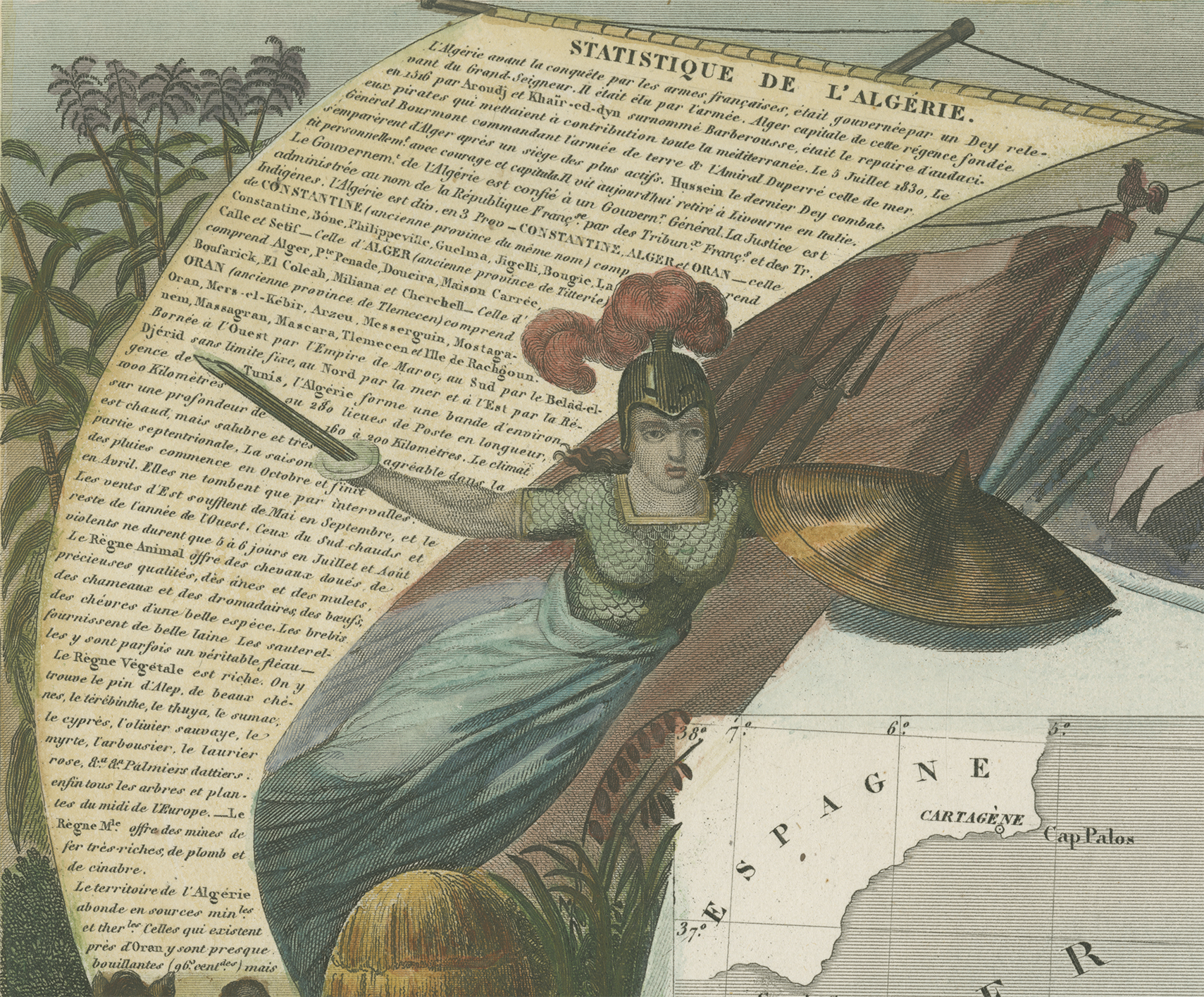
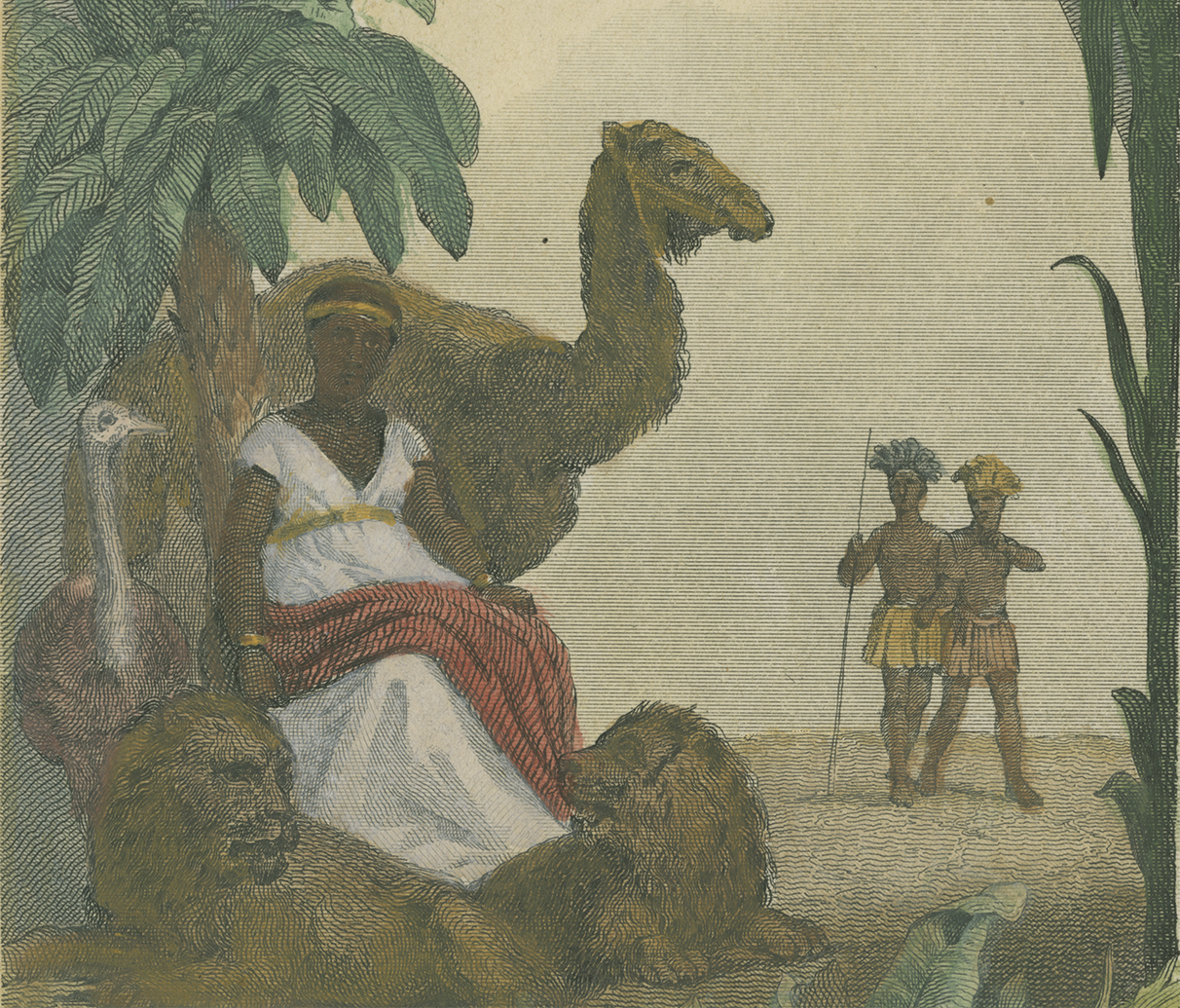
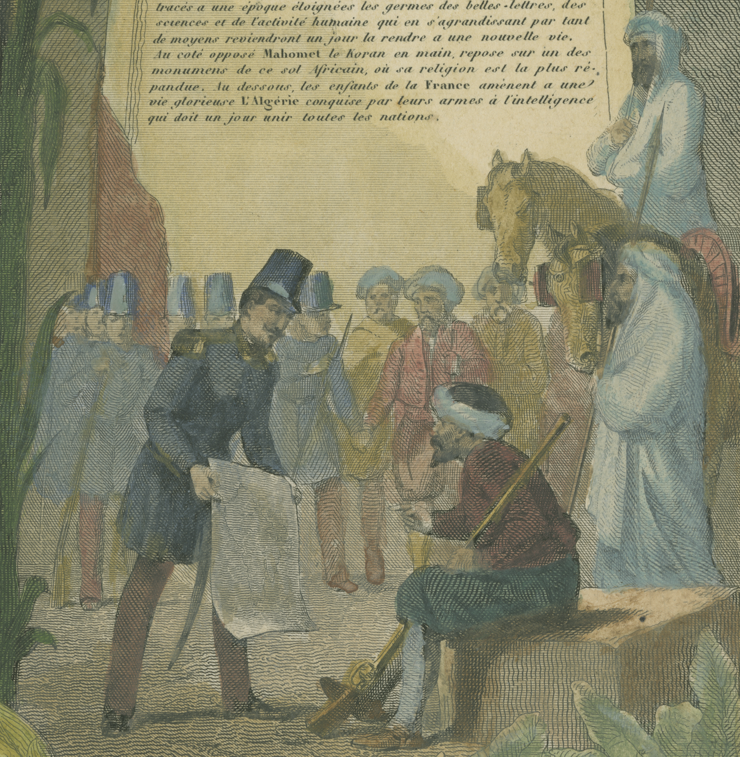
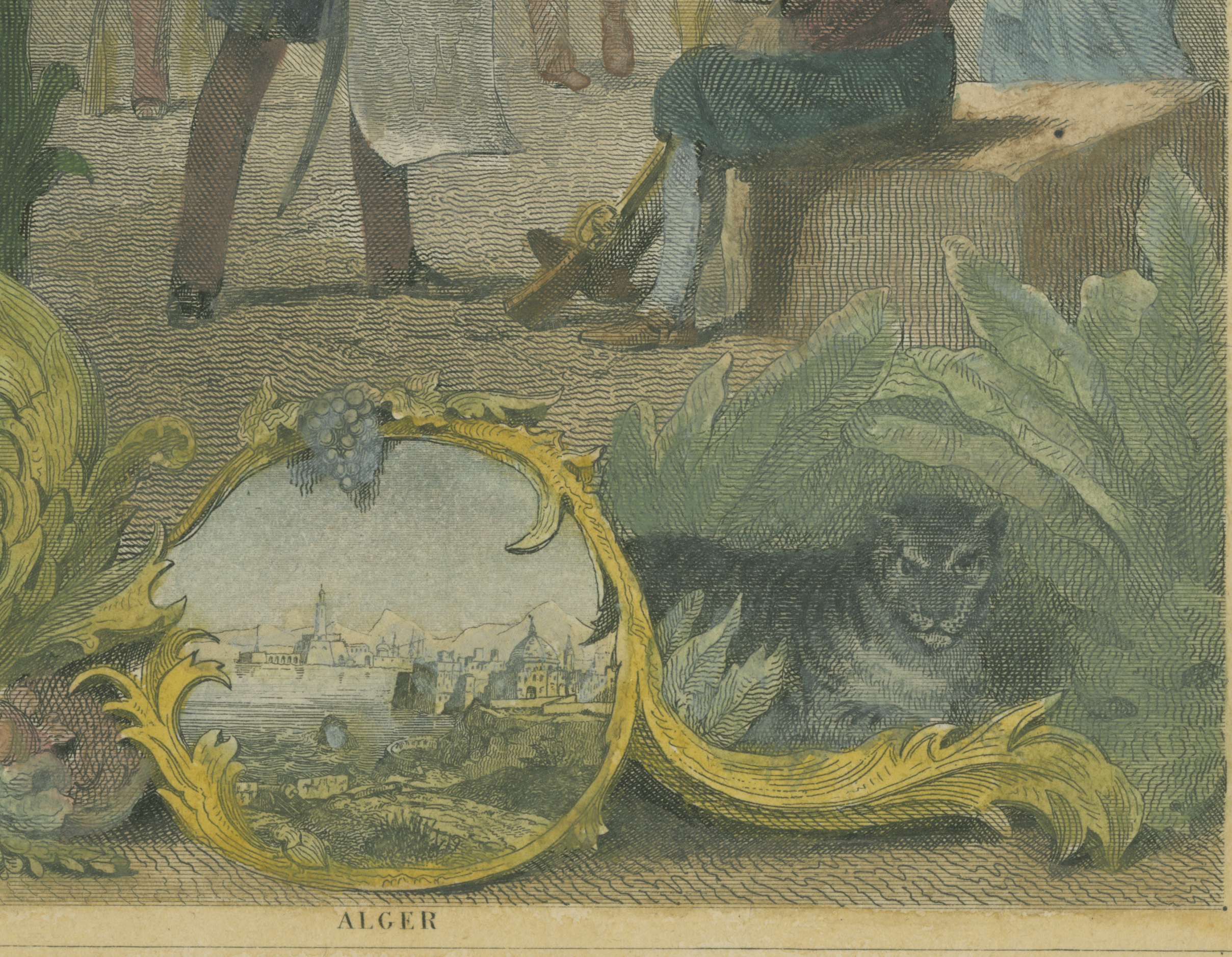
In the Searching for Africa exhibition, there is a collection of four maps created by French cartographer Victor Levasseur in the mid 1800s. These works captivated me due to the large number of cartouches and background illustrations surrounding the central maps. These compositions draw the eye with their color and beautiful scenes of regional environments, illustrated by A. M. Perrot and Raimond Bonheur for the Atlas National Illustre des 86 Departments et des Possessions de La France (National Atlas Illustrating the 86 Departments and Possessions of France), published by Levasseur (Huseman 2021). The title of this atlas is telling and I’ll return to that later. First, let’s explore two maps from this collection: Afrique (Figure 3) and Algérie. Colonie Francaise (Figure 4).
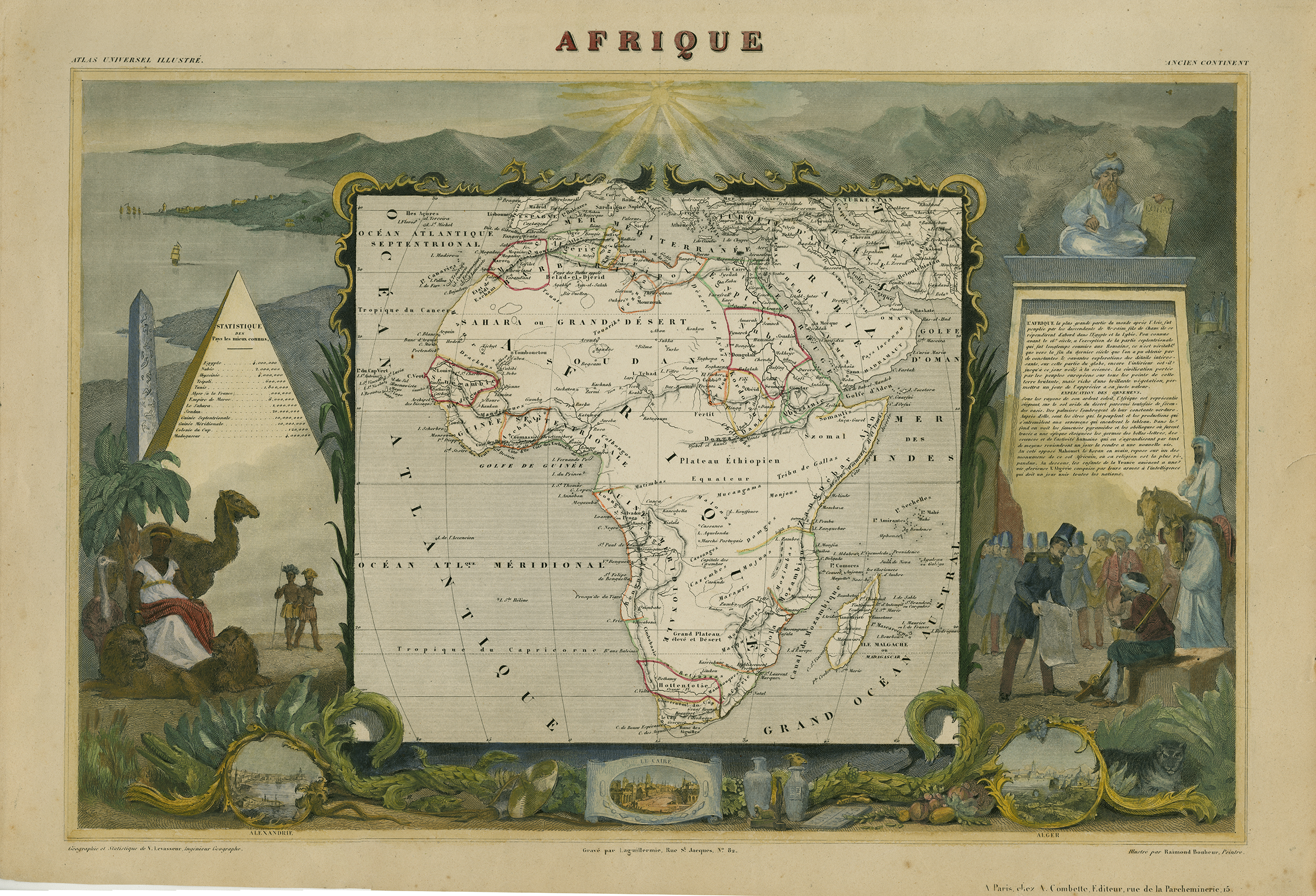
Figure 3: Victor Levasseur (cartographer), Afrique from Atlas National Illustre, 1849. UTA Libraries Special Collections. Currently on view in Searching for Africa exhibition at Special Collections.
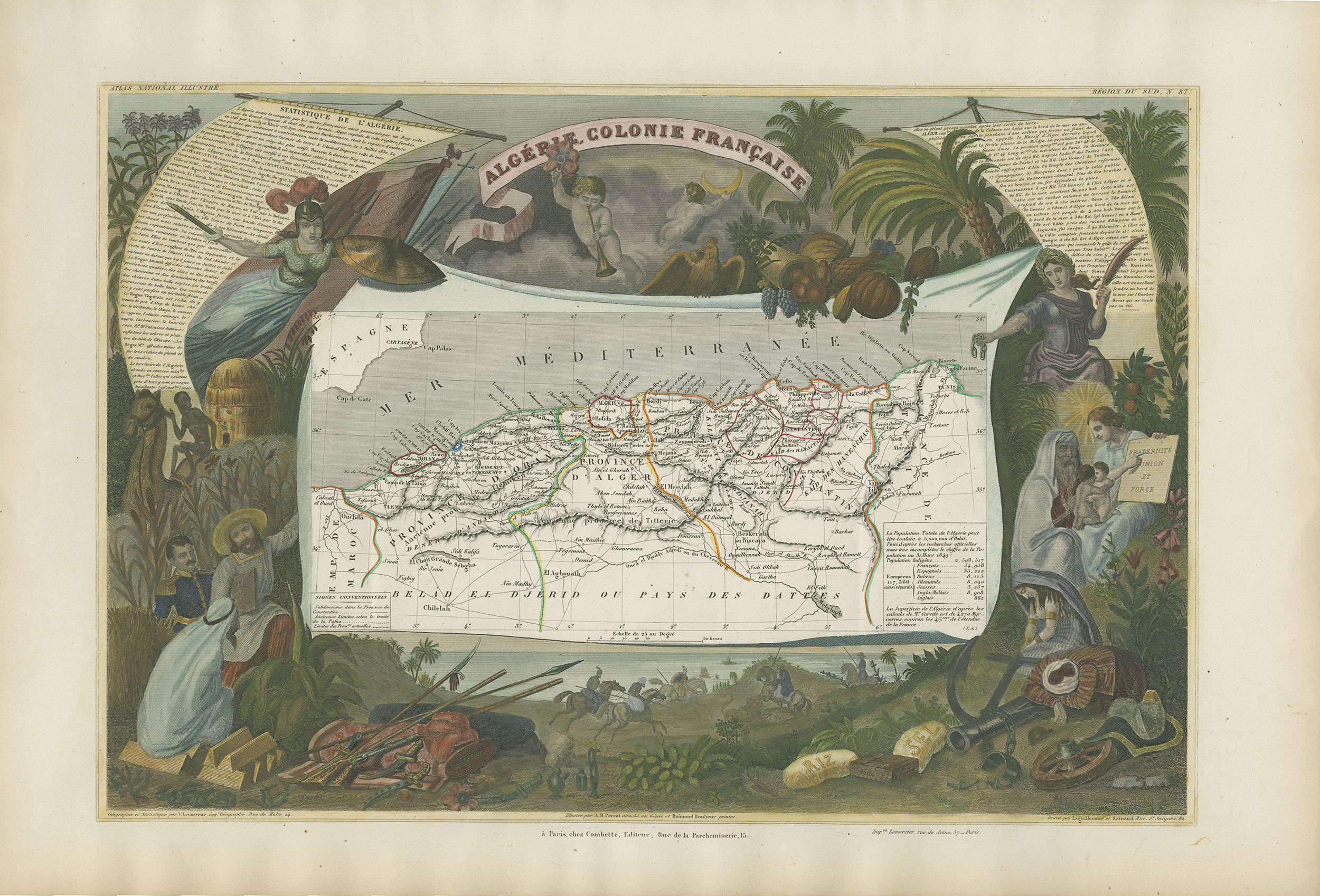
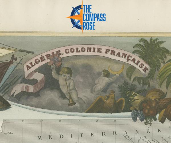
Figure 4: Victor Levasseur (cartographer), Algérie. Colonie Francaise. from Atlas National Illustre, 1854. UTA Libraries Special Collections. Currently on view in Searching for Africa exhibition at Special Collections.
The decorative scenes surrounding the relatively typical maps in Levasseur’s pieces are visually intriguing. I’ll focus on this component of the works, but it is also important to note that (unexpectedly perhaps) these works also incorporate regional population statistics and written descriptions of landscape and travel. This informational content is presented in text that is quite small and appears supplementary to the visual imagery. For example, in Figure 4 at the top left, an armored French maiden reminiscent of revolutionary “Lady Liberty” advancing the French flag holds her sword out wide over the text (Figure 4a). The viewer may miss the text altogether and focus their attention on that lady or the camel and Egyptian pyramid on the left in Figure 3. In front of the pyramid in Figure 3a, the illustrators depicted a linen-clad seated Black woman surrounded by lions and that camel. In the background behind her, two Black individuals in what appears to be ‘traditional’ attire stand with spears. Such depictions relate to my classmate Rebeca Compean-Serrano’s analysis in her recent blog post: “What I See in Historic European Maps of Africa Reminds Me of What I see in the News Today.”
The scene at the middle right in Figure 3 also drew my attention (Figure 3b). It shows how French officials engaged with native Africans. A standing French uniformed soldier presents a scroll to a seated North African man. Just below this scene, there is a cartouche with a miniature depicting the city of Algiers (Figure 3c). This suggests that the document the French officer presents to the seated man may relate to property seizure, taxation, or a similar action relevant to French colonization of what they called Algérie (Algeria) (Huseman 2021). The positions and the actions depicted are artistic choices that deliberately indicate the perceived contrast between the superior status of a French soldier and the inferiority of the seated native man.
Levasseur’s national atlas was created for the French (mainland) public, who may have interpreted these scenes as evidence of the good their country was doing for the less fortunate around the world. At the very least, such maps helped expose the French public to distant lands now becoming part of the Francophone (French-speaking) world.
Algerie. Colonie Francaise. (Figure 4) highlights the trade benefits the land provides, including bags of rice and salt, gold ingots, and weapons (Huseman 2021). A feeling of ownership, perhaps even entitlement, is communicated through this imagery and directly through the title of Levasseur’s atlas, which clearly uses the term “possessions.” These choices certainly indicate that the French viewer was meant to understand the benefits of colonization (to the French) and feel part of a large project to build France’s presence in the world. But what about that seated North African man? What about that woman? What about the “subjects” of these French colonies?
From outside that nationalistic French perspective, these maps appear as picturesque perceptions of colonization that beautify a history of oppression, ignoring political and cultural afflictions that impacted native people. The woman on the left in Figure 3 sits passively with her lion companions, as if viewing the French occupation lazily. The North African man “receives” the military document without question. These images paint a picture of pacification, sprinkled with the familiar imagery of revolutionary French spirit. But what underlies these choices is the disinterest in how these colonizing efforts impacted Africans. Such impacts were wide-ranging, from the horrific violence and terror of the Congo Free State to systemic cultural loss. For example, the French language was prioritized in the colonies of West Africa (or “Afrique Occidentale,” in Figure 2), so much so that native languages have died or are in the process of dying (Gwaambuka 2019). Scholars refer to this process as “linguistic imperialism” (ibid after Kofi Agyekum). The death of native languages that results from this process initiates the death of native culture, replaced with the globalized Francophone, or other European, traditions inserted via colonization (Gwaambuka 2019).
Such losses and impacts are not visualized in any of the maps represented here, certainly not in the “child-friendly” school textbook maps of Figures 1 and 2. Levasseur’s maps offer a beautified, propagandistic view of Africa but at least provide informative content about place (despite skirting around one of the primary underlying reasons for French interests in Africa: competition with the British about who could colonize the most and the best). The school maps only illustrate colonialism and the point of view of the colonizers. Overall, this experience learning about historic maps of Africa, especially these fancy French examples, has shown me how the maps used to educate me about the history of Africa when I was young are woefully lacking in context, inclusivity, and holistic educational value. I wonder how different our educational systems would be if maps like Figures 1 and 2 were paired with factual reflections of the injustices and tragedies perpetrated in Africa and the strength and resilience demonstrated by the peoples of Africa.
Alexander, Nathan G. 2016. "E.D. Morel (1873–1924), the Congo Reform Association, and the History of Human Rights." Britain and the World 9, no. 2: 213–235.
Gwaambuka, Tatenda. 2019. “Losing Africans in Translation: The Death of African Languages is the Death of Africans.” The African Exponent (December 14, 2021). https://www.africanexponent.com/post/4816-africans-lose-themselves-as-they-lose-their-languages
Huseman, Ben W. Searching for Africa: The Map Collection of Dr. Jack Franke Gallery Guide. Arlington, TX: UTA Libraries Special Collections, 2021.
Levasseur, Victor and Raymond Bonheur. Afrique [map]. Scale not given. In: Atlas National Illustré. Paris: A. Combette, 1849. UTA Library Special Collections.
Levasseur, Victor, Aristide Michel Perrot, and Raymon Bonheur. Algerie, Colonie Francaise [map]. In: Atlas National Illustré. Paris: A. Combette, 1849. UTA Library Special Collections.
Senelle, R., and E. Clément. 2009. Léopold II et la Charte Coloniale. Brussels: Editions Mols.
Sliwinski, Sharon. 2006. "The Childhood of Human Rights: The Kodak on the Congo". Journal of Visual Culture 5, no. 3: 333–63. doi:10.1177/1470412906070514.
Twain, Mark. 1905. King Leopold’s soliloquy a defense of his Congo rule. Boston: P. R. Warren Co.
Add new comment