
by Ben Huseman
by Ben Huseman
The purpose of The Compass Rose is to raise awareness of Special Collections' resources and to foster the use of these resources. The blog series also reports significant new programs, initiatives, and acquisitions of Special Collections.
Note: This is Part Two of a continuing series of Compass Rose posts on Special Collections' city views. Click here for City Highlights (Part One): African Cities from the Nuremberg Chronicle)
Thanks to a recent purchase and some gifts by UTA alumnus Dr. Jack Franke (class of 1987), UTA Libraries Special Collections now has more original pages from Sebastian Münster's highly-influential Cosmographei (Cosmography), first published in 1544. For almost a century, Münster's work was "the principal source of geographical, ethnographical and scientific knowledge" (in much of Europe, at least), with 36 complete editions and reprints appearing between 1544 and 1628. Most of these were in the original German, but there were also Latin, French, Italian, and Czech translations.1
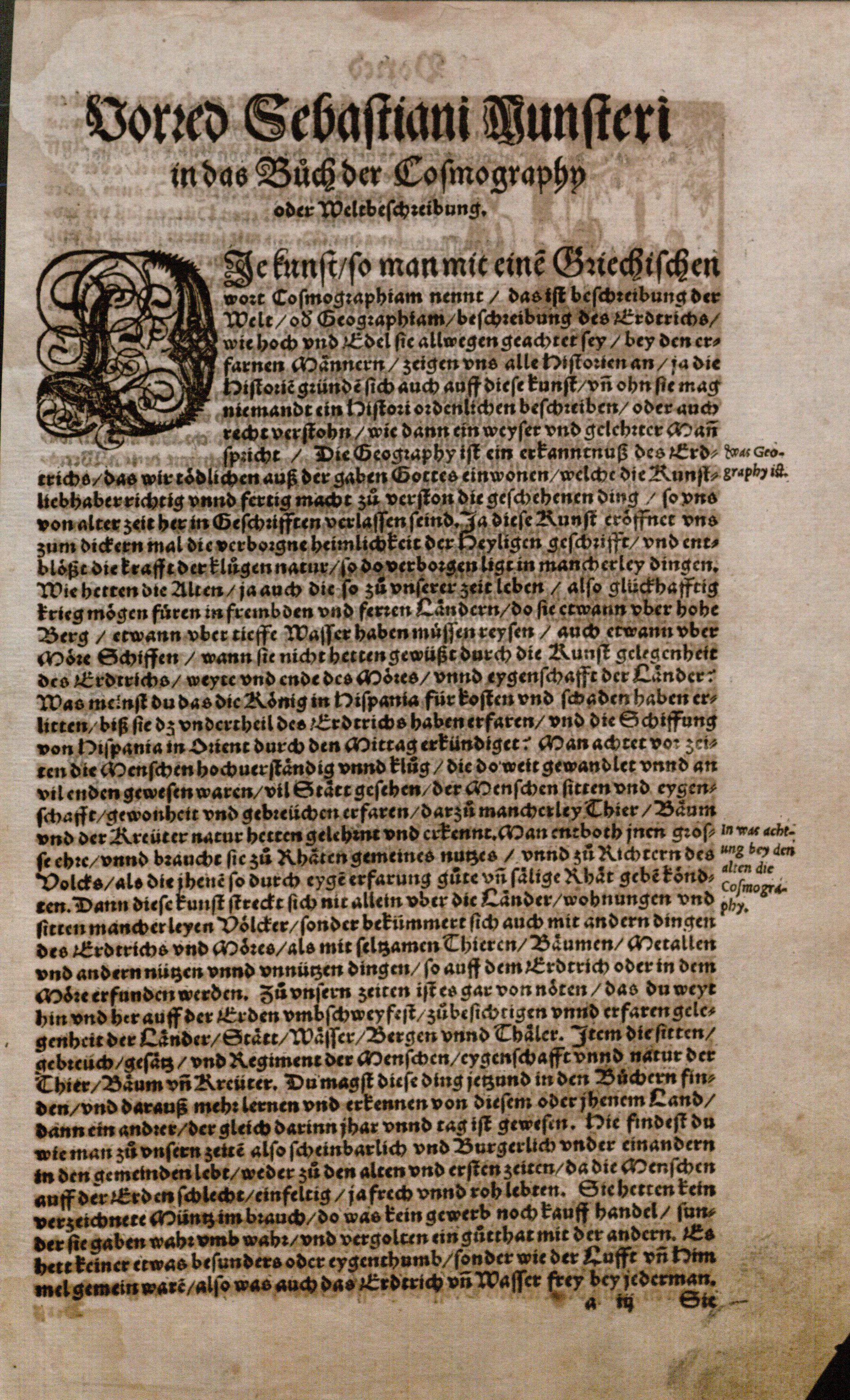
Sebastian Münster's Preface page from the Cosmographei (Basle: Heinrich Petri, 1578). UTA Libraries Special Collections
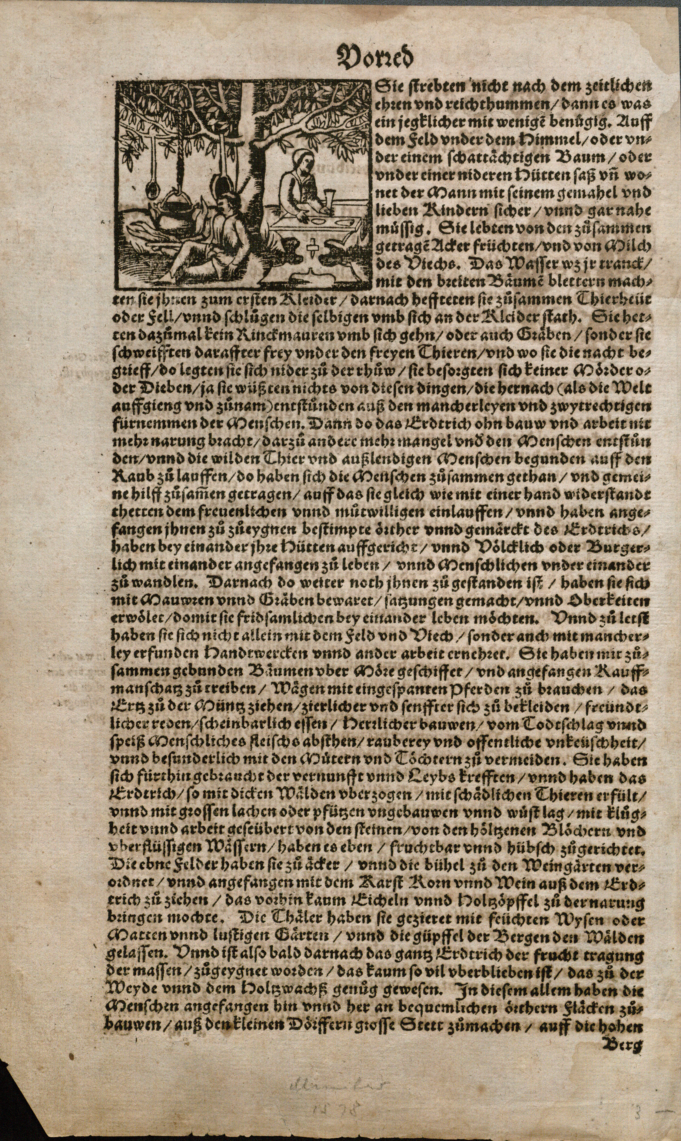
Sebastian Münster, Cosmographei (Basle: Henrich Petri, 1578), Preface, page two. UTA Libraries Special Collections
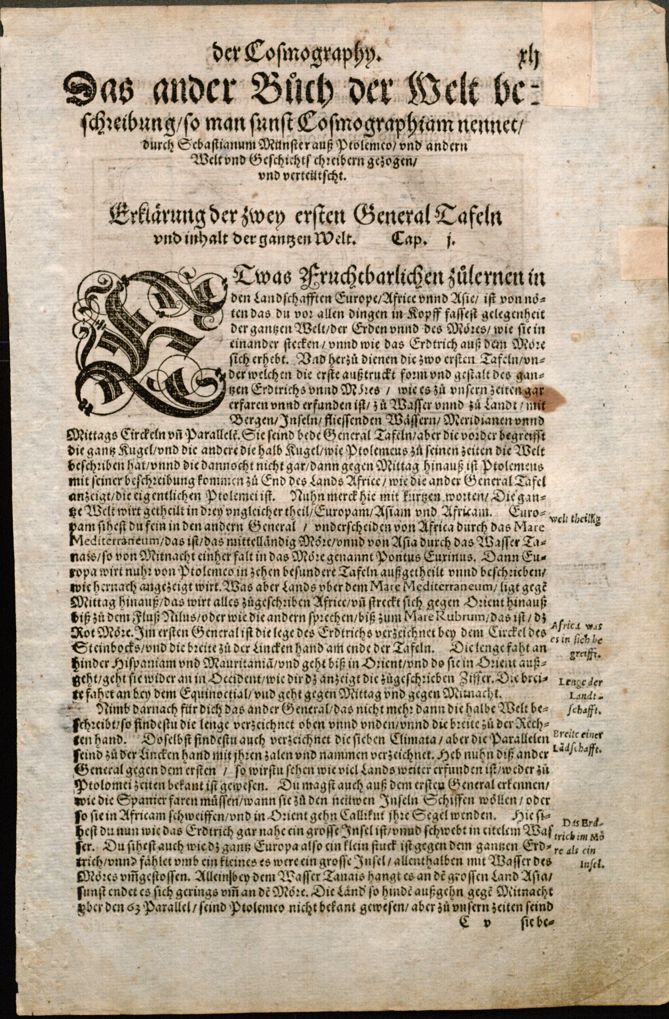
An original page of text from Sebastian Münster's Cosmographei (Basle: Heinrich Petri, 1578). UTA Libraries Special Collections
Author Sebastian Münster (1488-1552) was a German humanist, theologian, and scholar who taught divinity and philosophy at Tübingen University (in southwestern Germany, established in 1477) and served as Professor of Hebrew at Heidelberg University (in west central Germany, established in 1386) and the University of Basle (Switzerland, founded in 1460). His Cosmographei went well beyond previous cosmographies (descriptions of the cosmos) that had focused upon mathematics, astronomy, geography, and some history, by aiming to cover not only this but also to include a brief description of all lands of the entire known world by compiling masses of topographical, genealogical, ethnographical, anthropological, and scientific data. To do this he searched printed and manuscript sources and solicited material from a wide network of scholars and others. He also traveled.2
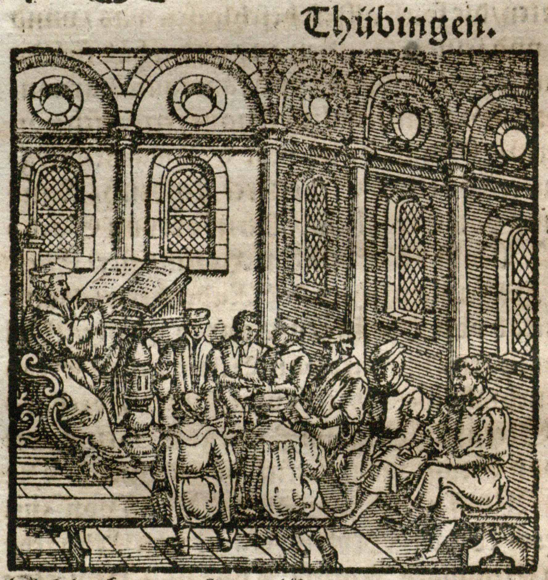
A Professor Lecturing at the University of Tübingen (where Münster taught), woodcut, from Münster, Cosmographei, 1578. UTA Libraries Special Collections
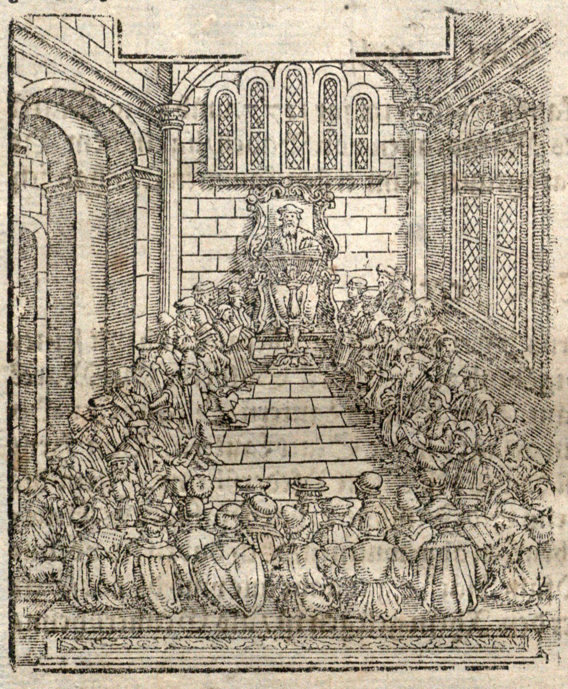
A Professor (Dr. Münster?) Lecturing at Heidelberg University, woodcut (this example, a lighter, worn impression), from Münster, Cosmographei, 1578. UTA Libraries Special Collections
Münster's one-volume encyclopedia was no dry reading intended for scholars only, however. Anyone with minimal literacy could enjoy the profuse illustrations and text that included tales of adventure, anecdotes, and even some superstitious folklore that Münster himself did not necessarily believe. Working in the middle of religious wars and other conflicts, Münster tried to avoid current politics, so that Catholic monks as well as Protestant pastors could access his information.3
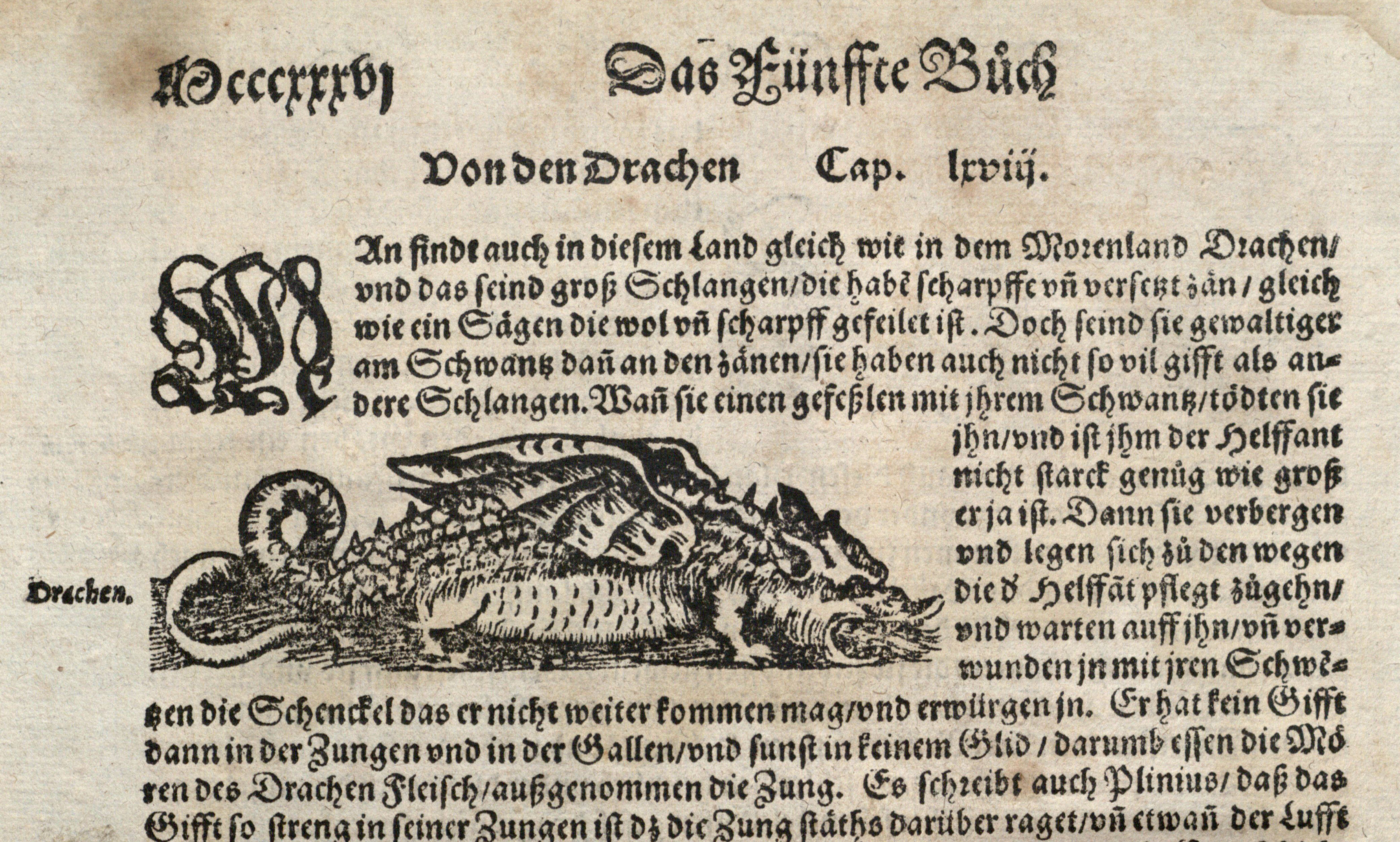
Drachen [Dragon], woodcut with letterpress, detail from page 836, fifth book, chapter 68, from Münster, Cosmographei (Basle, 1588). UTA Libraries Special Collections
Münster's woodcut maps and illustrations, and in particular the numerous city views, were an important feature of the Cosmographei. In Basle, Münster's stepson Heinrich Petri (1508-1579), who was a printer and map publisher involved in the project throughout its long publishing history, occasionally had worn woodcuts recut and continued to add and update the city views, maps, and illustrations. This practice continued long after Münster died in Basle from the plague in 1552. The Cosmographei's success inspired rival works that also influenced later editions of the Cosmographei itself. Although substantially different, these competitors included such enormously successful cartographic classics as Abraham Ortelius' Theatrum Orbis Terrarum (Theatre of the World), the world's first true atlas, first published beginning in 1570, and Georg Braun and Frans Hogenberg's Civitates Orbis Terrarum (Cities of the World), an atlas of city views first published beginning in 1572.3
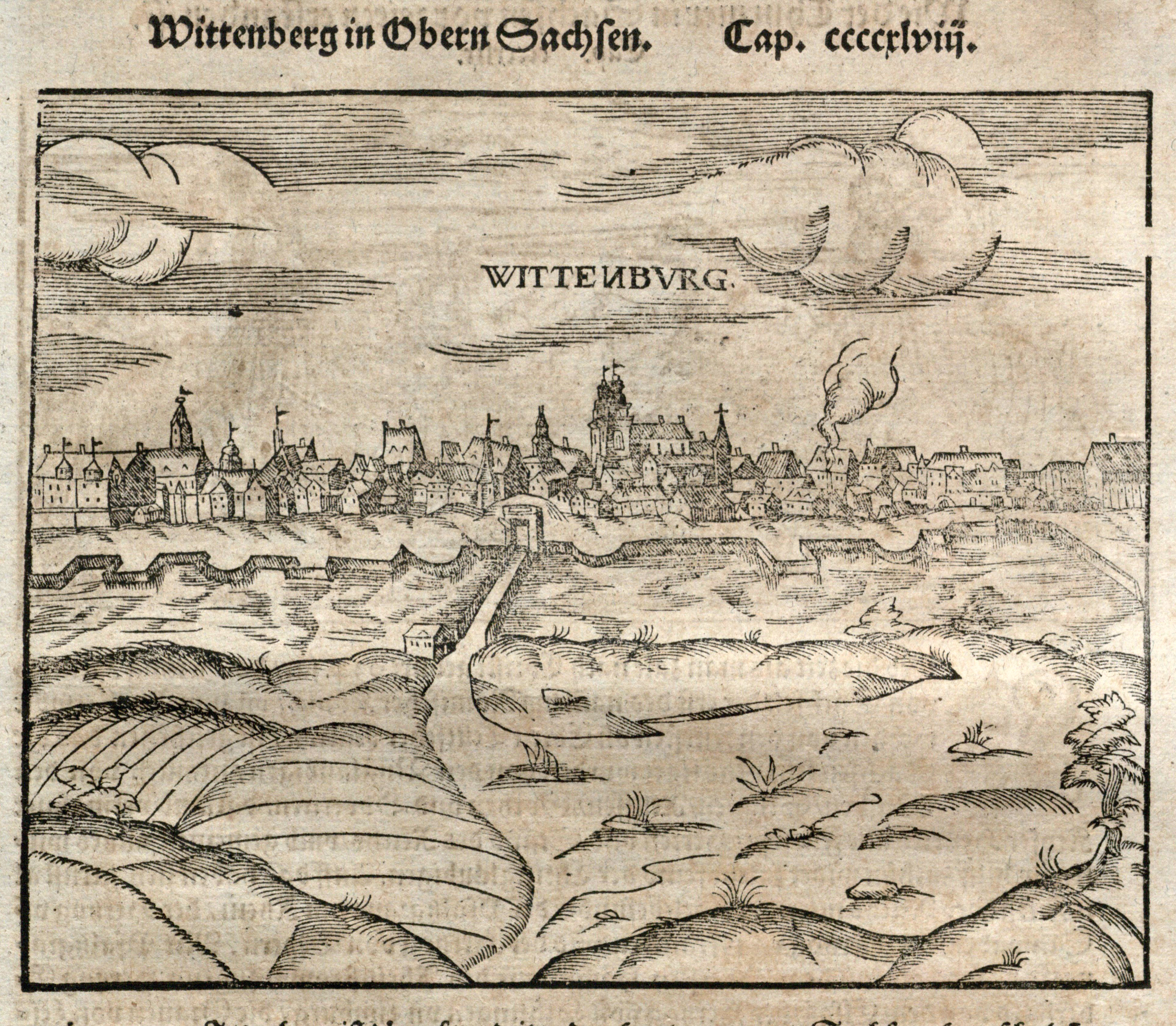
Wittenberg, Upper Saxon university town with important links to the Protestant Reformation, woodcut from Münster, Cosmographei, 1578. UTA Libraries Special Collections
The Greek city of Rhodes, captured by the Ottoman Turks in 1522, woodcut, from Münster, Cosmographei, 1578. UTA Libraries Special Collections
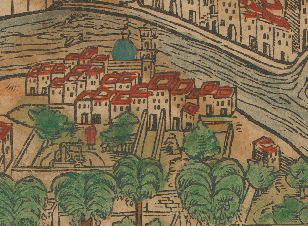
The city of Eger (Cheb, Bohemia), double-page woodcut from Münster, Cosmographei, 1578. UTA Libraries Special Collections
The city views in Cosmographei vary from profiles (drawn as if seen from a viewpoint on the ground or just above), bird's-eye views (seen obliquely from a higher elevation), plans (drawn from directly above), or a combination of these techniques. The woodcut city views also exhibit a considerable range of quality, not only in terms of printing quality, but also in terms of artistry and accuracy. Much of the latter depended upon the source for the image, with later editions generally reflecting greater accumulated knowledge. The later edition city views tend to be more detailed, suggesting that the appearance of other books with copperplate engravings, like, for example, the Braun and Hogenberg world city atlas, forced Petri to update in order to compete.
Thionville, then a Hapsburg city now in France, woodcut from Münster, Cosmographei, 1578. UTA Libraries Special Collections
Edinburgh, Scotland, woodcut view with a descriptive letterpress key below, from Münster, Cosmographei, 1578. UTA Libraries Special Collections
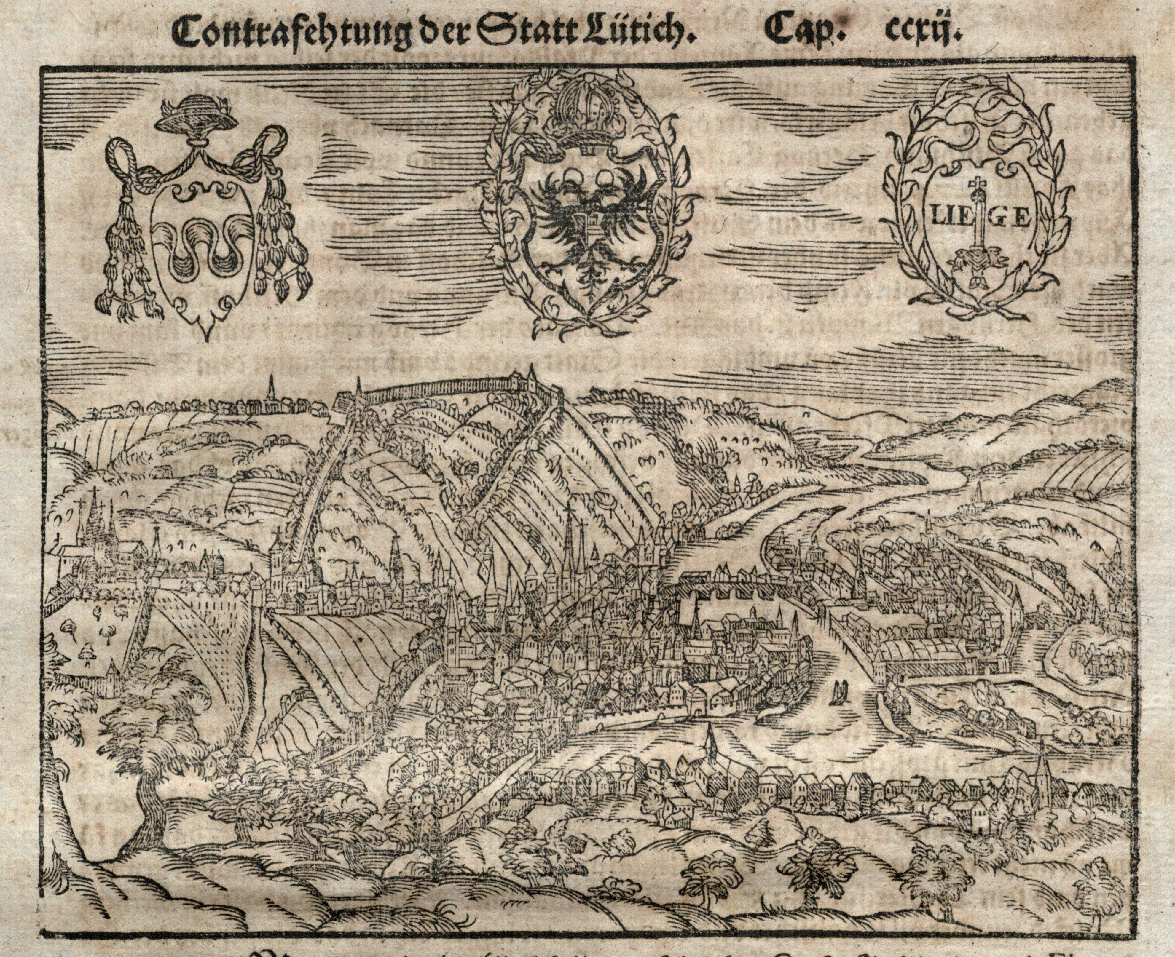
Lüttich (Liege, Belgium), woodcut from Münster, Cosmographei, 1578. UTA Libraries Special Collections
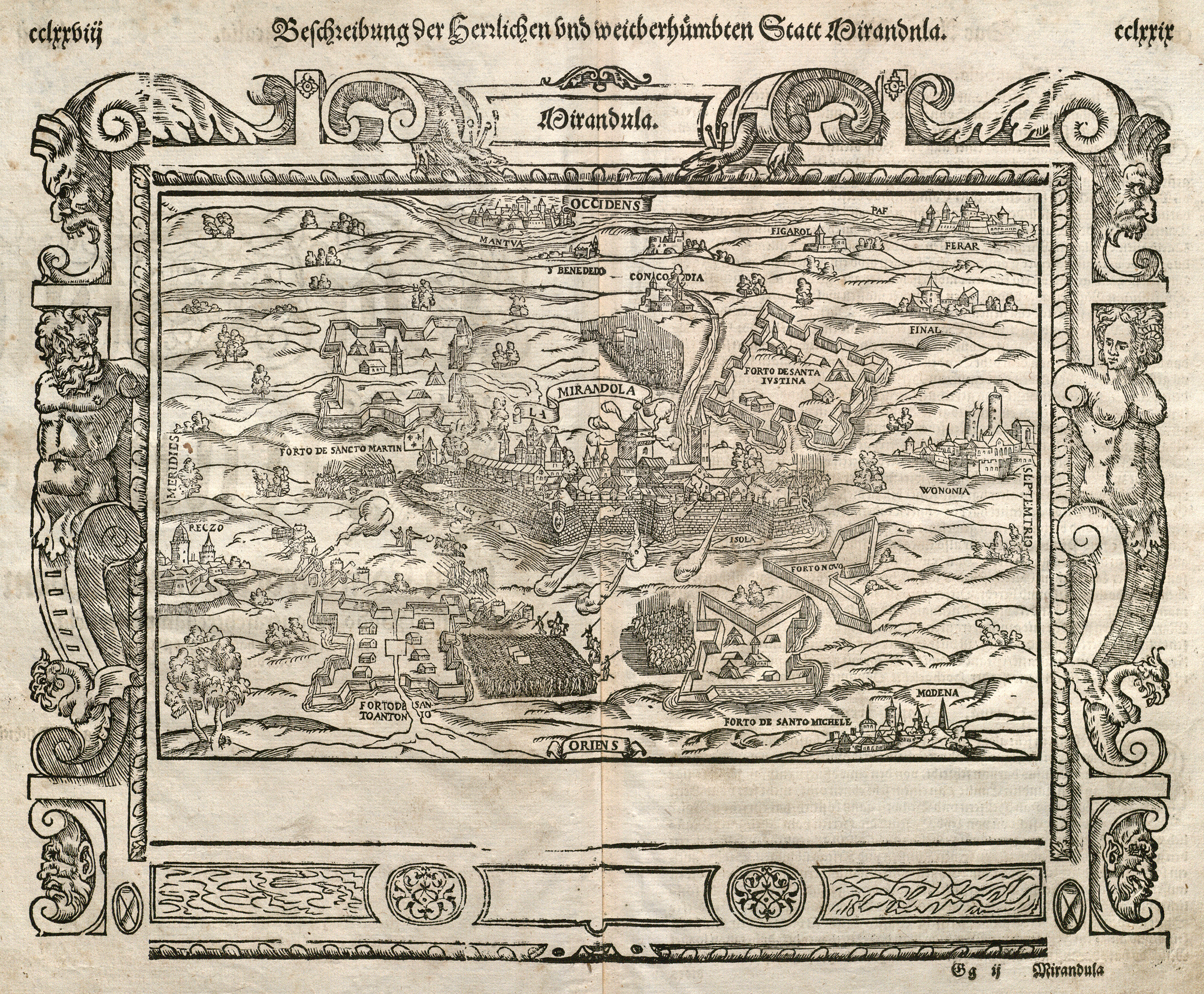
The fortress city of Mirandola in Lombardy, northern Italy, woodcut from Münster, Cosmographei, 1578. UTA Libraries Special Collections
Strassburg (Strasbourg, France), woodcut from Münster, Cosmographei, 1578. UTA Libraries Special Collections
Aachen, Germany, woodcut from Münster, Cosmographei, 1578. UTA Libraries Special Collections
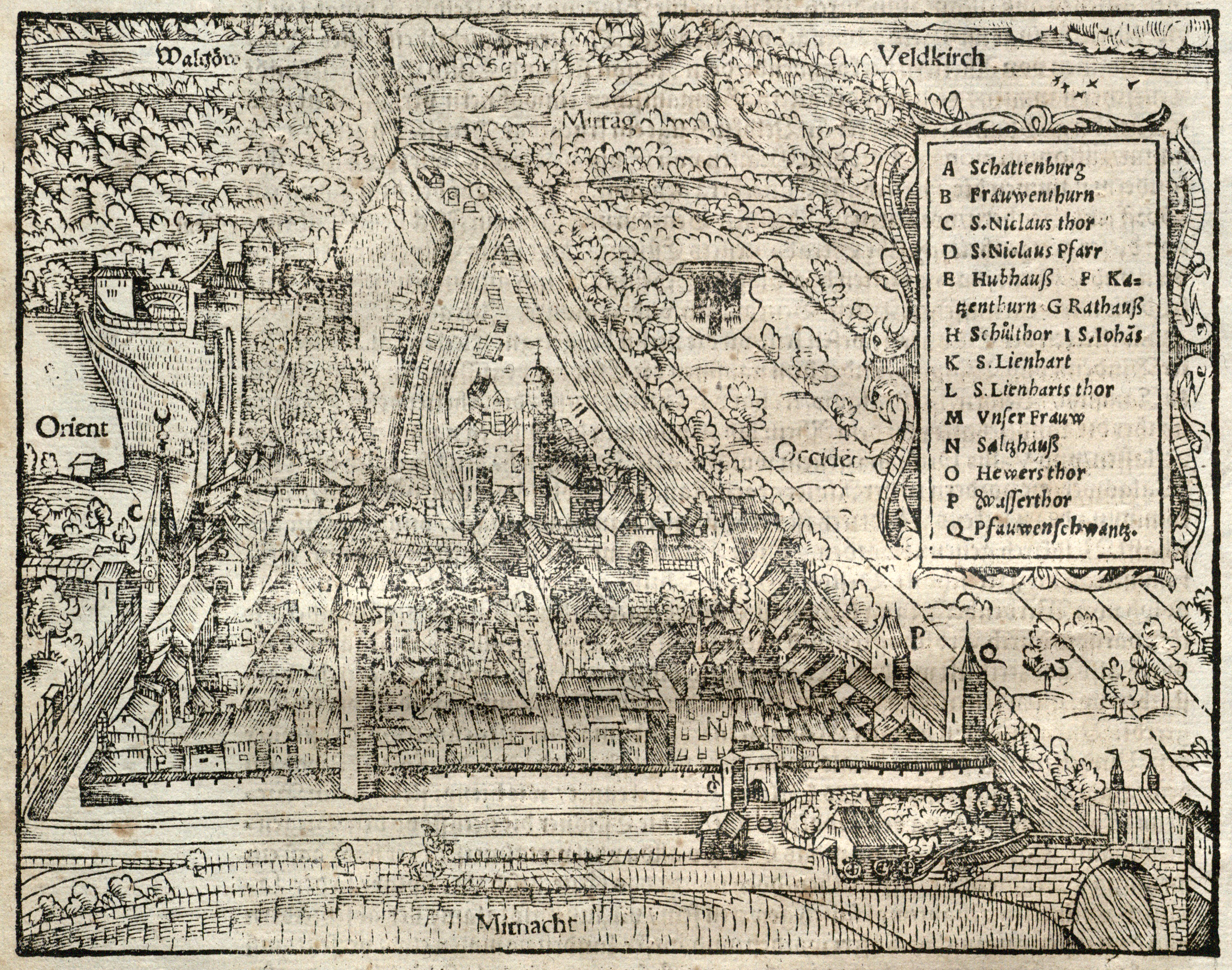
Feldkirch, Austria, woodcut from Münster, Cosmographei, 1578. UTA Libraries Special Collections
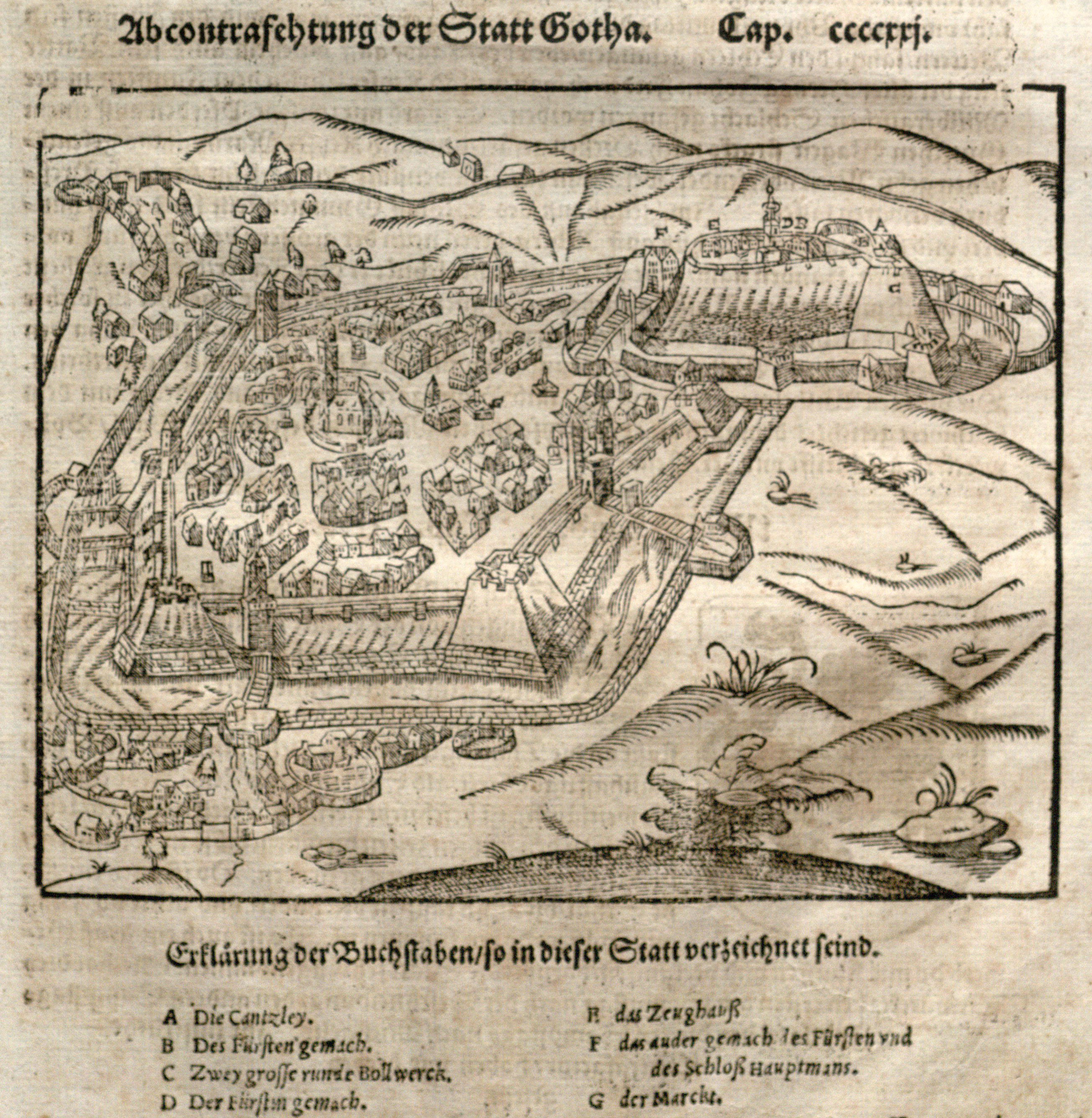
Gotha, Germany, woodcut from Münster, Cosmographei, 1578. UTA Libraries Special Collections
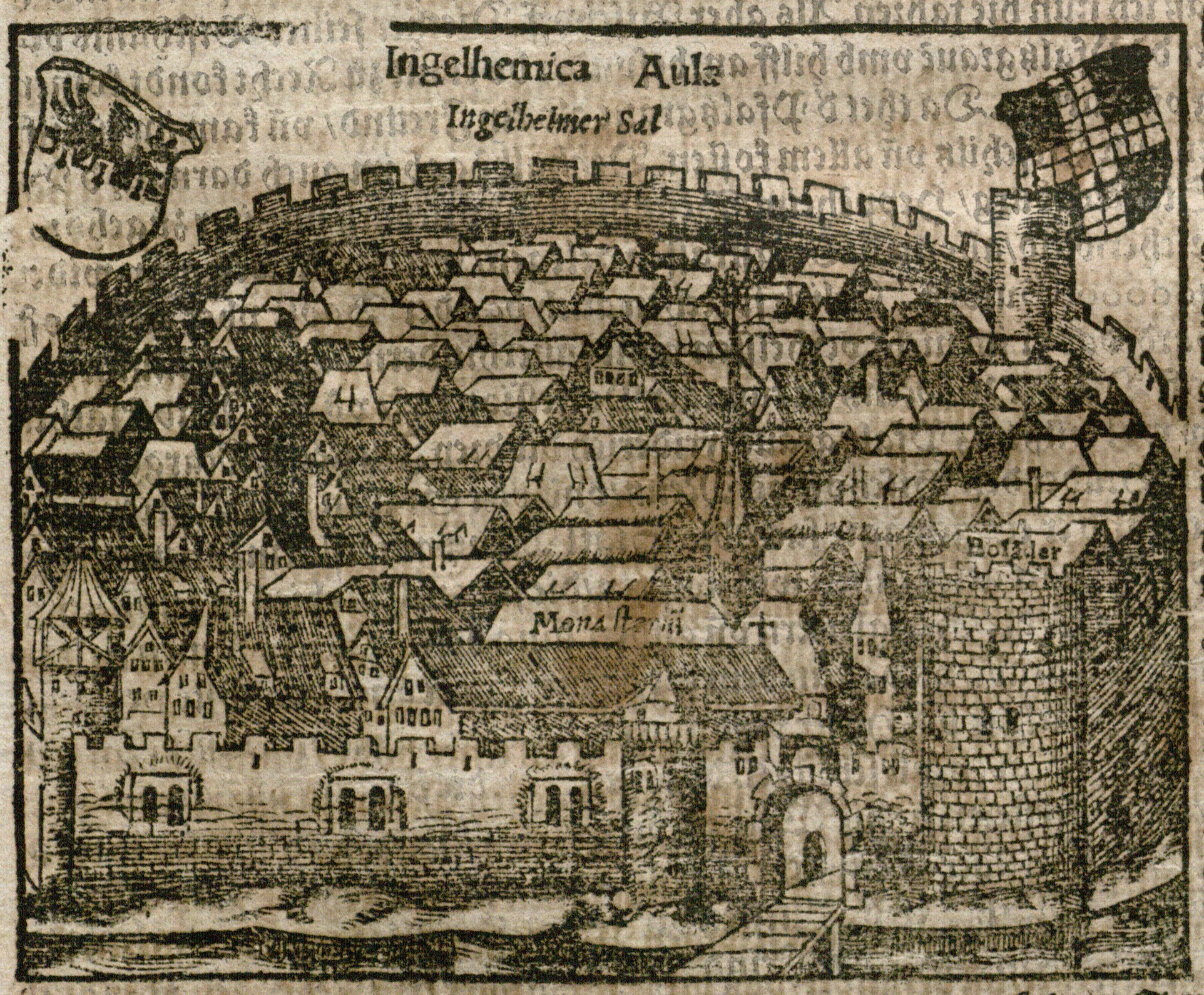
Ingelheim am Rhein (Germany), birthplace of Sebastian Münster, woodcut from Münster, Cosmographei, 1578. UTA Libraries Special Collections
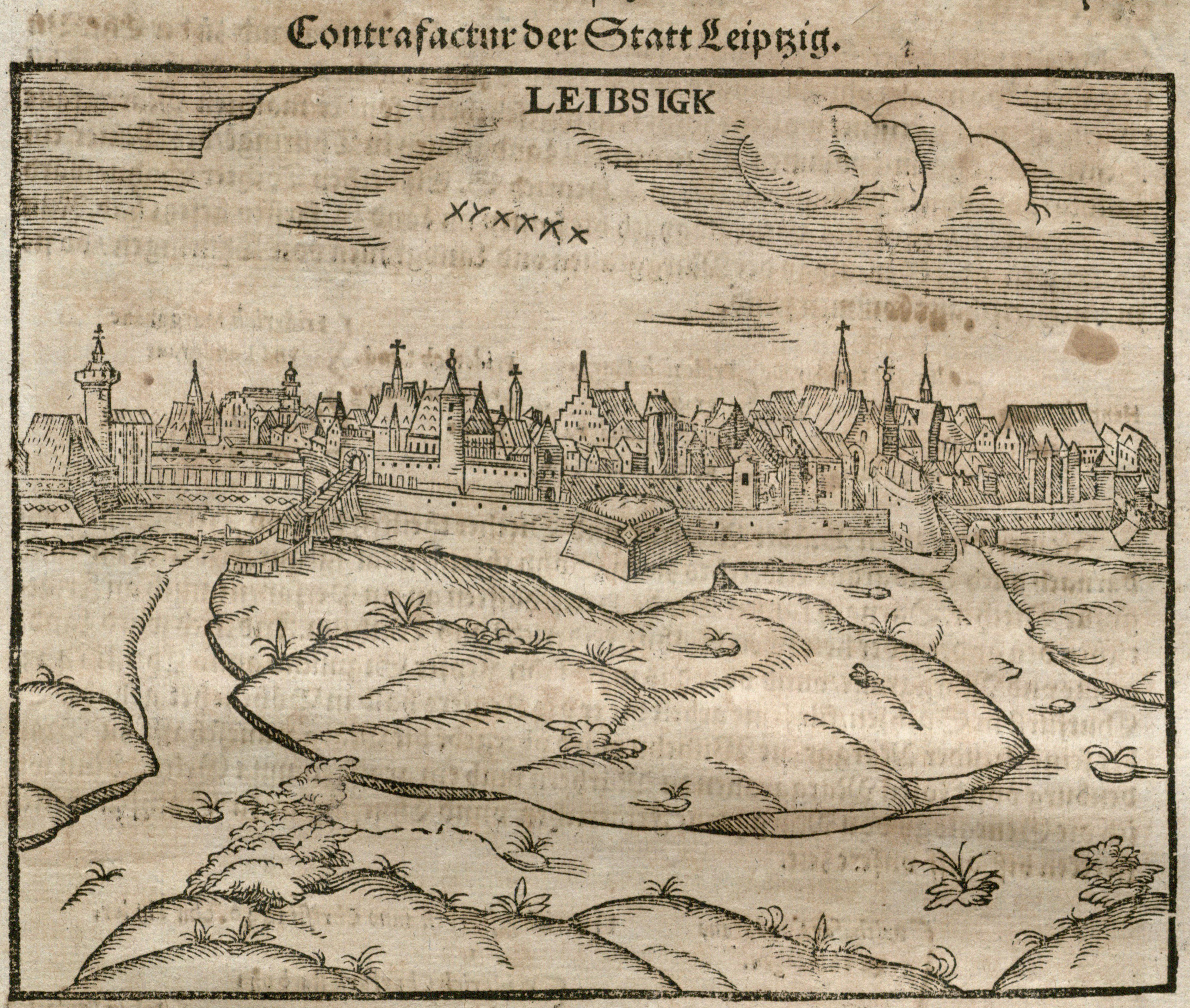
Leipzig, Germany, woodcut from Münster, Cosmographei, 1578. UTA Libraries Special Collections
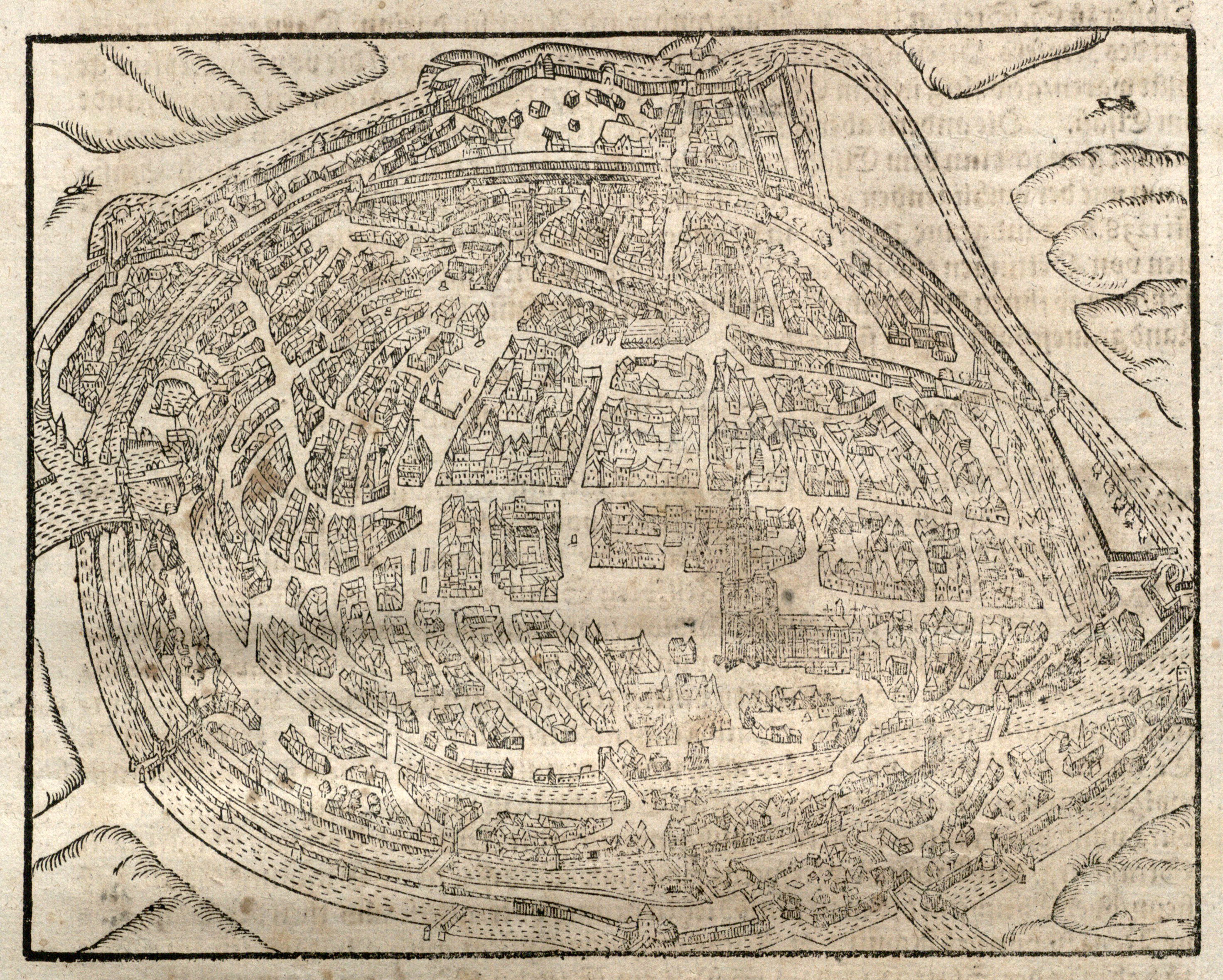
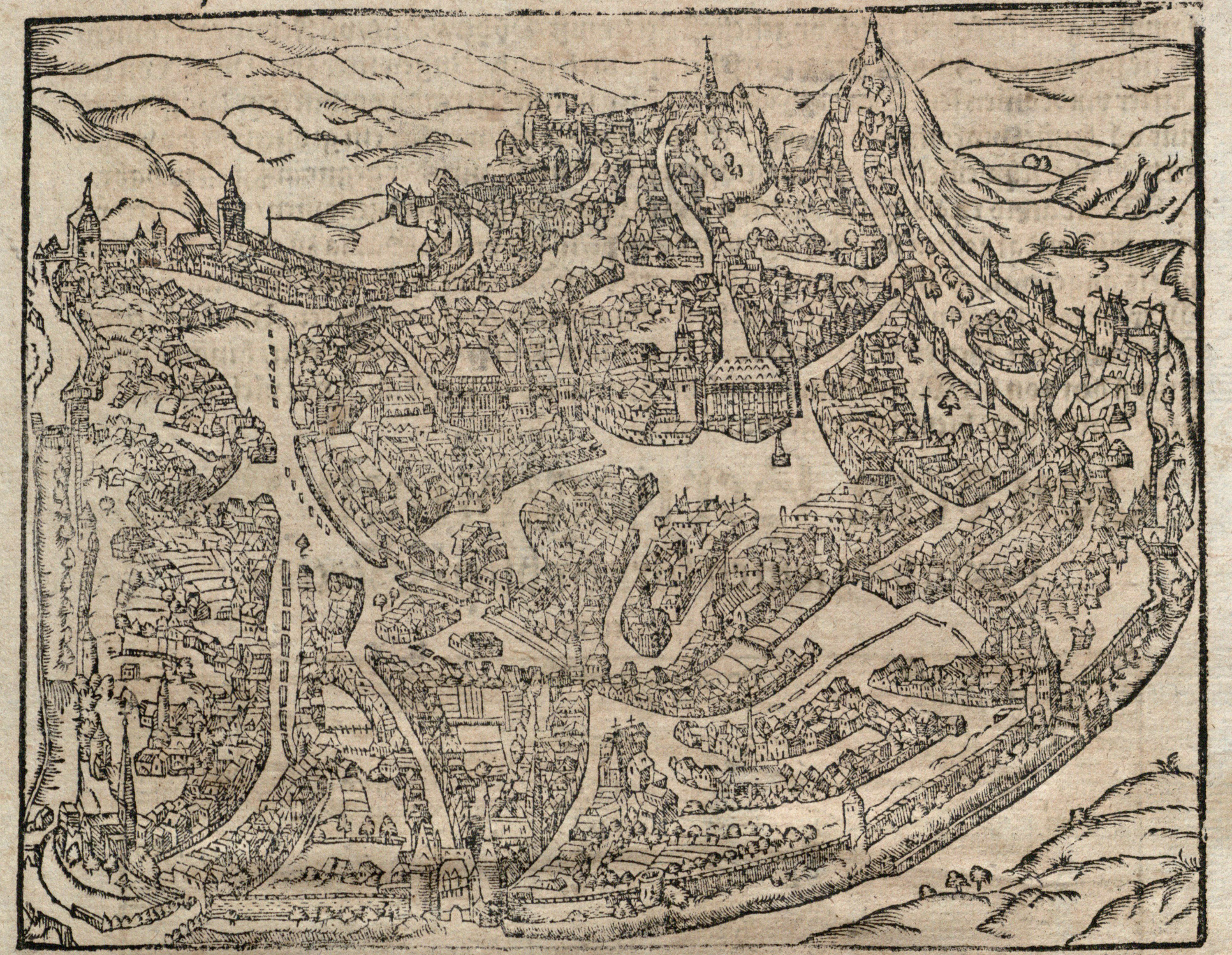
Among the original pages from various editions of Münster's Cosmographei now at UTA Libraries Special Collections are city views of Paris (in need of conservation and restoration); Thionville, (then belonging to the Hapsburgs, today part of France); Lüttich (Liege, present-day Belgium); Mirandula (Mirandola, Lombardy, Italy); Edinburgh (Scotland); Feldkirch (Austria); Argentoratum (Strassburg or Strasbourg, in present-day France); Ach (Aachen), Ingelheim, Leibsigk (Leipzig), Wittenberg, and Gotha (all in present-day Germany), and Eger (Cheb, Bohemia, present-day Czech Republic).
Although Munster's Cosmographei was naturally weighted towards European cities, the publishers did include some Asian and African cities. Of the latter, UTA has two examples, thanks to Dr. Franke's continuing donations: Algiers and Cairo.
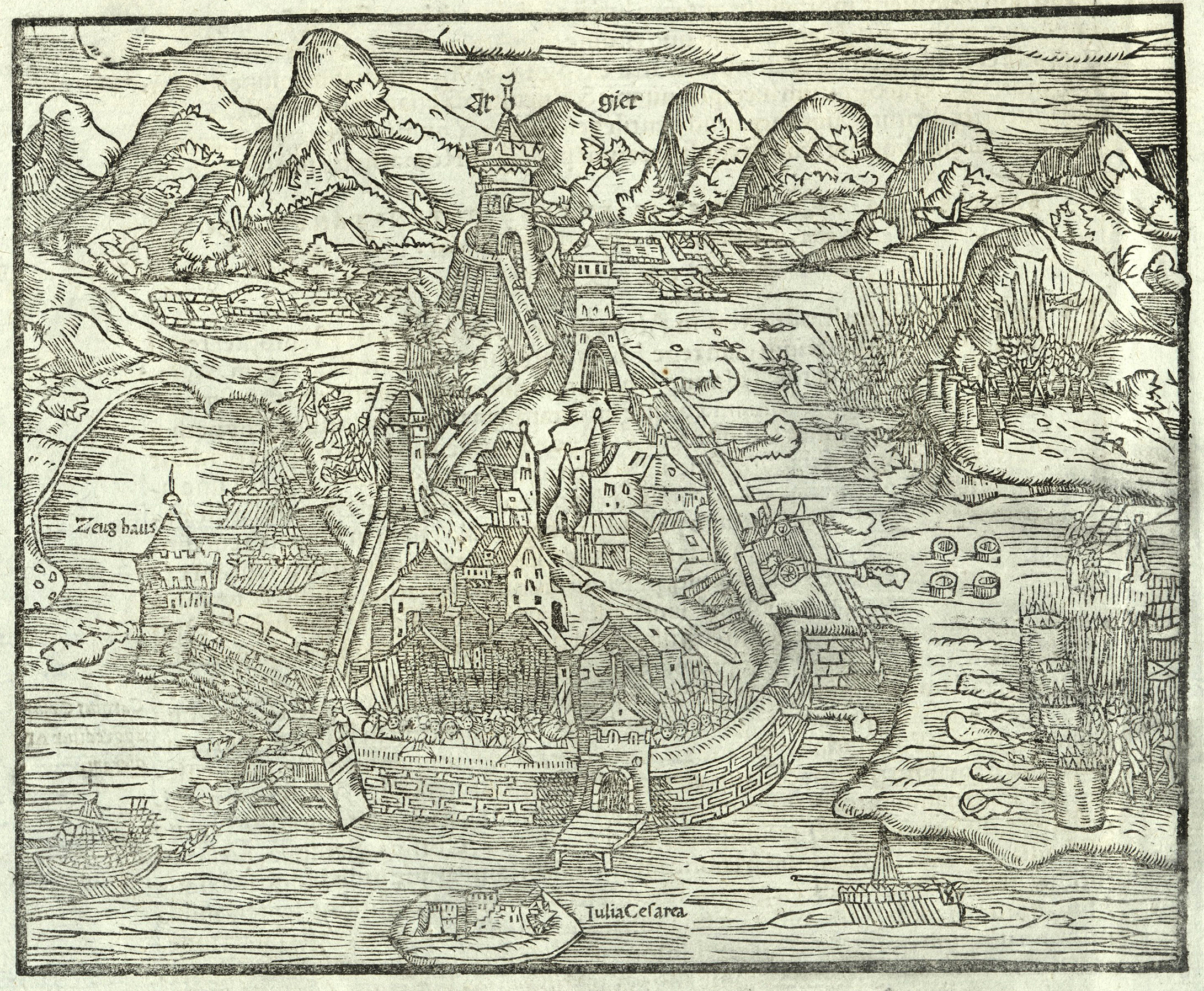
Algier[s], woodcut, 1550, from Münster, Cosmographei, 1558. UTA Libraries Special Collections
The woodcut of Algiers depicts the 1541 siege of the Muslim-ruled city by forces personally led by Holy Roman Emperor Charles V. A tower labeled "Zeug Haus" or armory stands at left and the ancient Roman island port of "Julia Caesarea" may be seen in the foreground at the bottom of the image. At right, the allied Christian forces with pikes stand behind gabions (cylindrical wicker cages filled with rocks, sand, or soil) for protection as their cannon duel with the Moorish cannon (all belching smoke and fire) from behind the city's walls and fortifications. Rowed war galleys ply the surrounding waters. The siege was a disaster for the Christian forces despite the participation of Spanish military celebrities including Hernán Cortés (who had recently returned to Spain from Mexico).
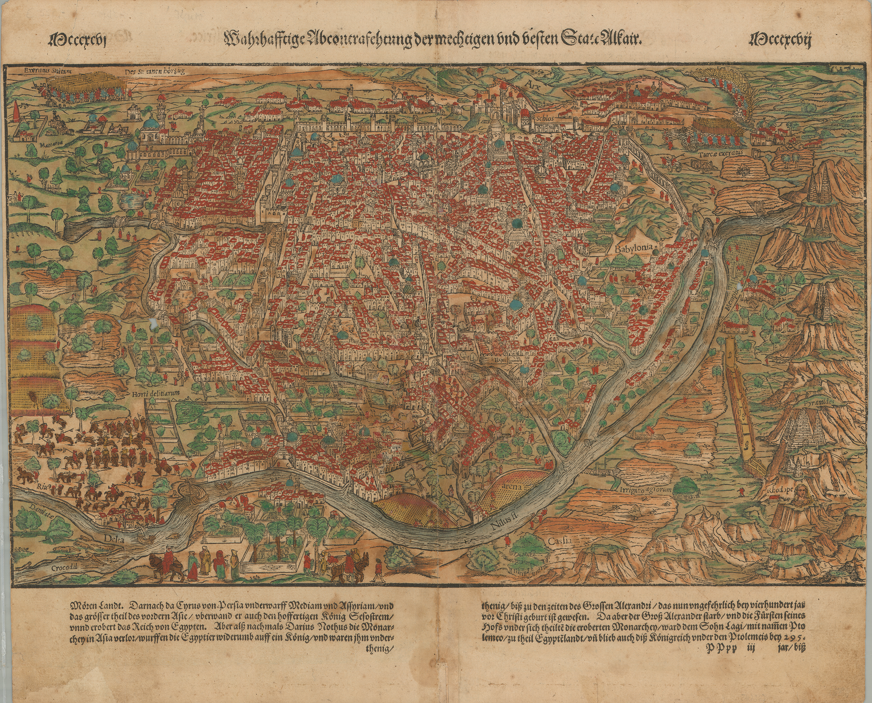
D.R. After Giovanni Domenico Zorzi, Cairo, Egypt, woodcut with applied color on paper, from Münster, Cosmographia (Basle: Heinrich Petri, 1575).. UTA Libraries Special Collections, Gift of Dr. Jack Franke
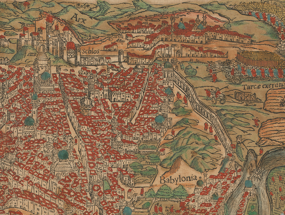
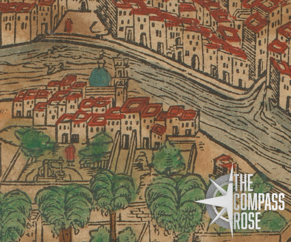
Detail of the Cairo view showing the Sultan's fortress and palace at the upper left, Turkish army exercises, the aqueduct leading from the Nile River, at lower right, and the old town quarter known as "Babylonia" from Münster, Cosmographei, 1578. UTA
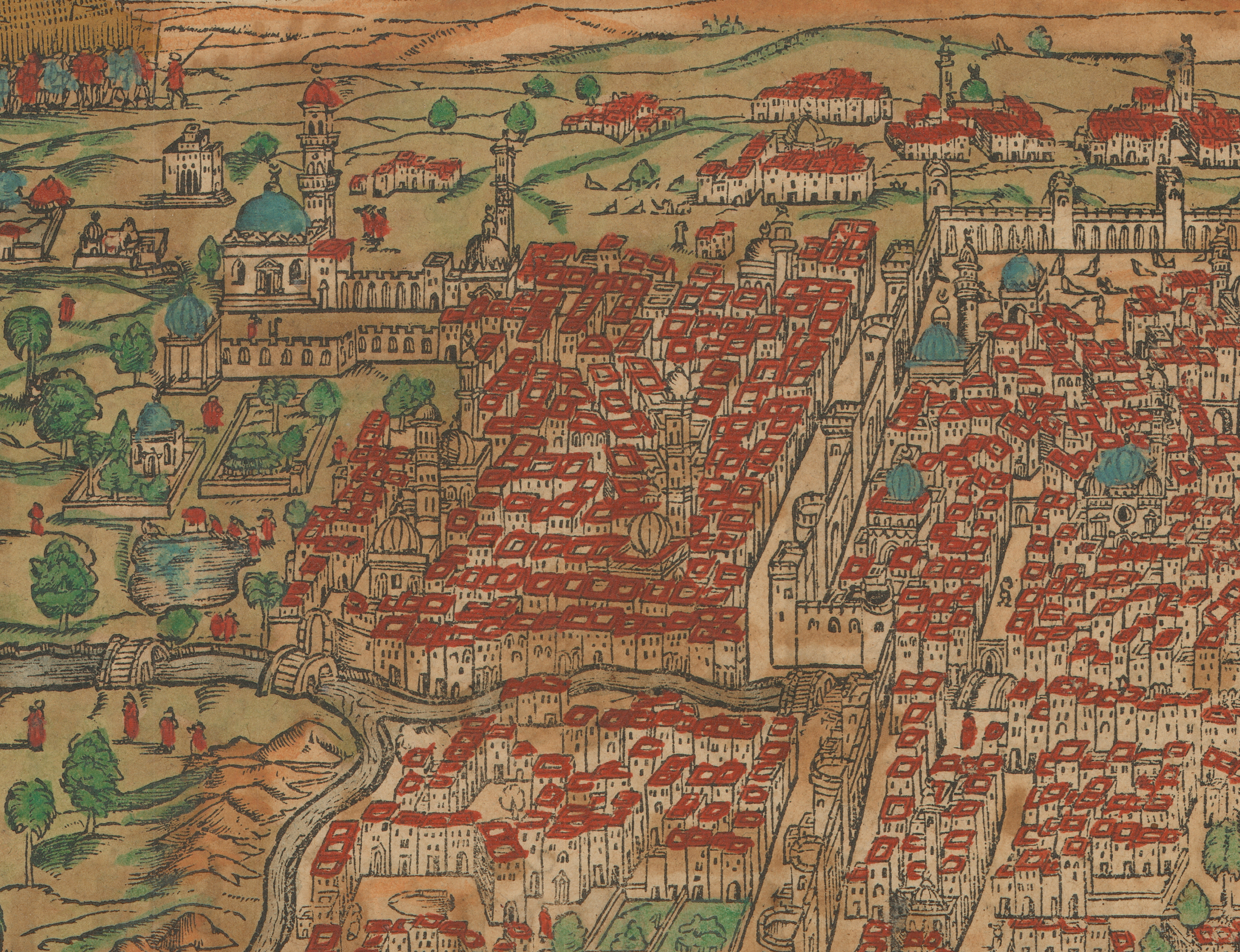
Detail of Cairo showing a great mosque, city fortifications, and other buildings, woodcut from Münster, Cosmographei, 1578. UTA Libraries Special Collections. Gift of Dr. Jack Franke
A mosque, suburb, and garden lying across the Nile from Cairo, detail of woodcut from Münster, Cosmographei, 1578. UTA Libraries Special Collections. Gift of Dr. Jack Franke
The woodcut view of Cairo, signed at lower right with the monogram “D.R.,” was reduced from a woodcut wall map of Cairo originally printed on 21 sheets by Matheo Pagano in Venice around 1549. The Pagano map was originally compiled by Giovanni Domenico Zorzi (ca.1487-ca.1550), a Greek-born painter and cartographer working for the Venetian Council of Ten. In the 1540s Zorzi traveled to Jerusalem by way of Cairo, where he made firsthand observations that informed his map. A close inspection of the Cairo view offers delightful details, including the Sultan's palace, mosques, houses, gardens, fortresses, and other structures.
Other pages from Münster's Cosmographei at UTA feature small maps of Europe, the British Isles, France, western Germany and part of the Low Countries, the Swiss canton of Valais, Brabant in the Low Countries, Africa, and Egypt (the latter two thanks to Dr. Jack Franke). These maps now compliment a map of the world, a map of the Americas (from the Virginia Garrett Collection), and two maps of Africa (from Dr. Franke) representing an early and late edition, and all from Munster's update of the Geographia of Claudius Ptolemy first published in Basle in 1540.
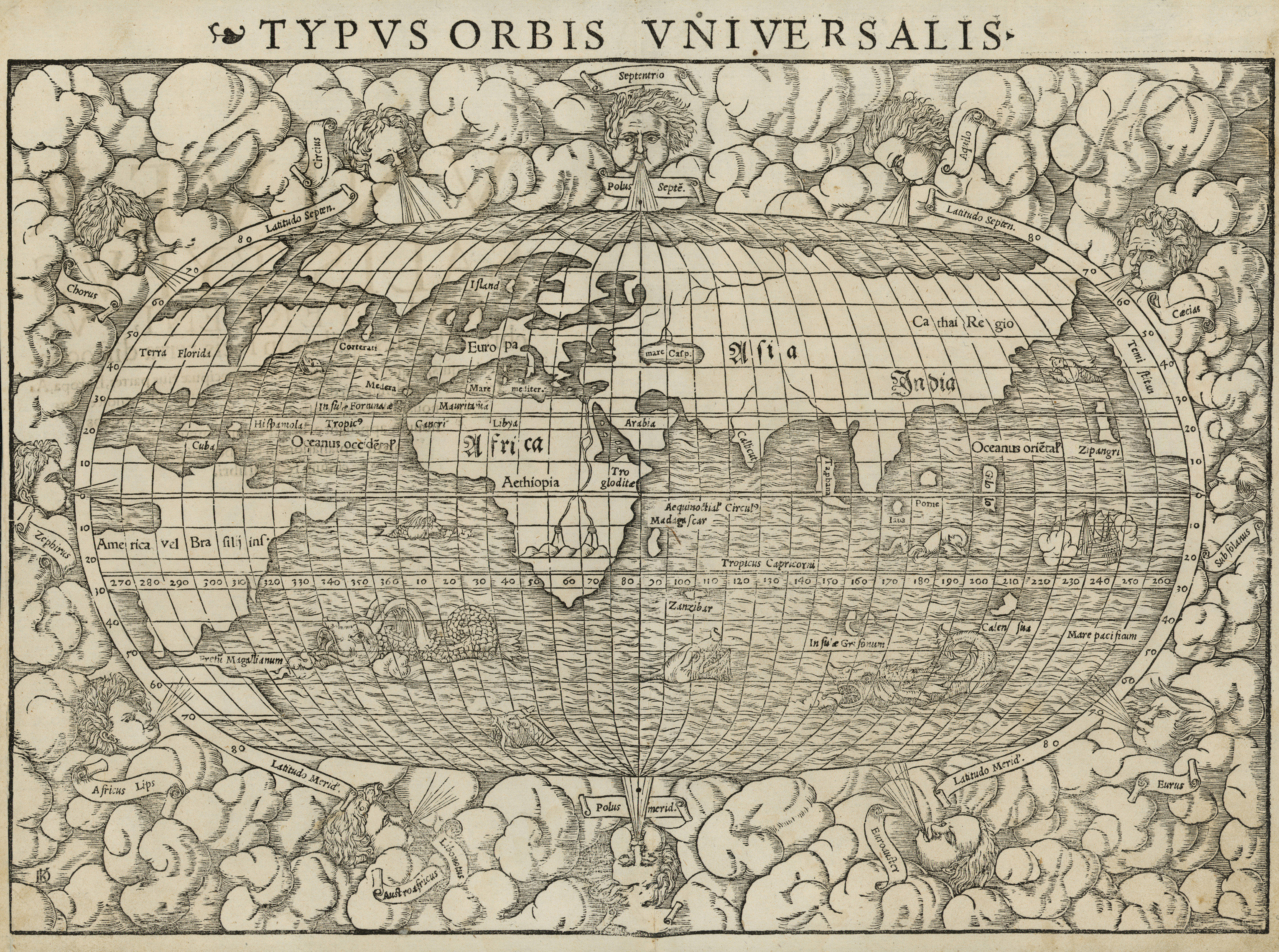
Typus Orbis Universalis [World Map], woodcut from Münster, Cosmographia or Geographia (Latin edition), 1550. UTA Libraries Special Collections
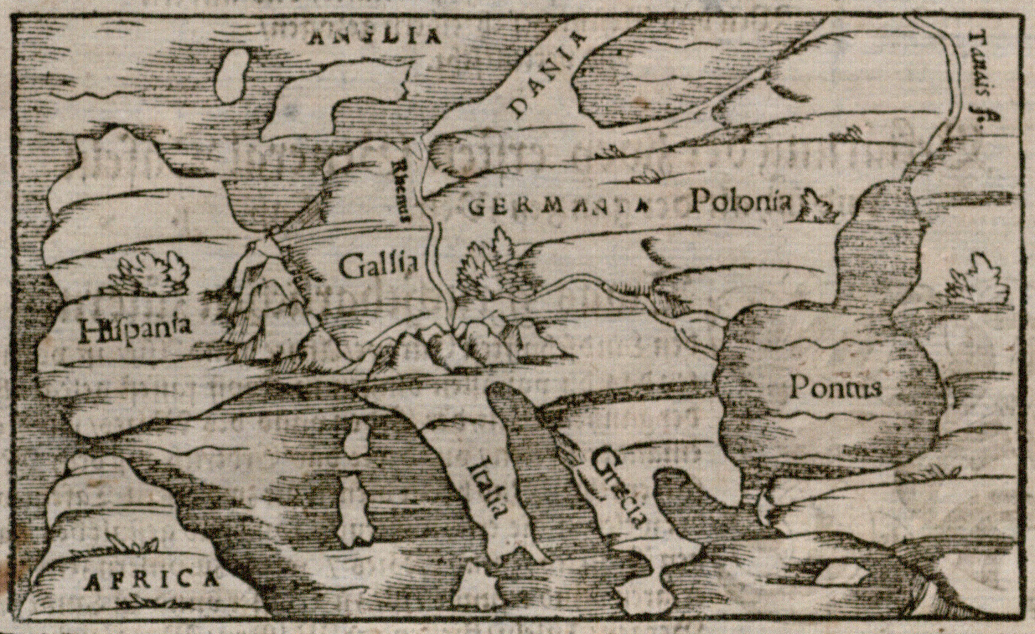
Europa, woodcut from Münster, Cosmographei (Basle, 1578). UTA Libraries Special Collections
![[British Isles], woodcut from Münster, Cosmographei (Basle, 1578). UTA Libraries Special Collections.](/sites/default/files/2020-09/Anglia.jpg)
[British Isles], woodcut from Münster, Cosmographei (Basle, 1578). UTA Libraries Special Collections
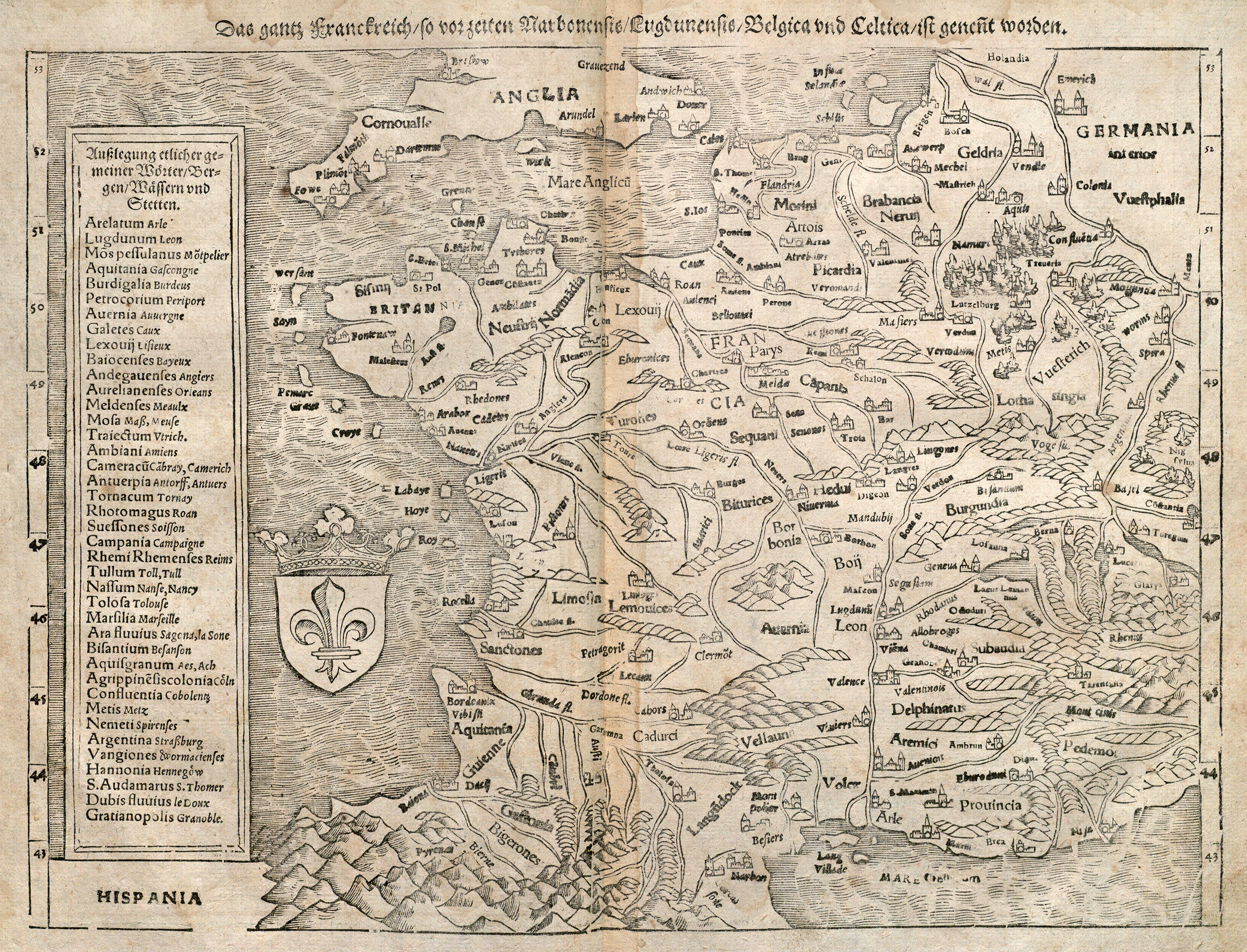
France, woodcut from Münster, Cosmographei (Basle, 1578). UTA Libraries Special Collections
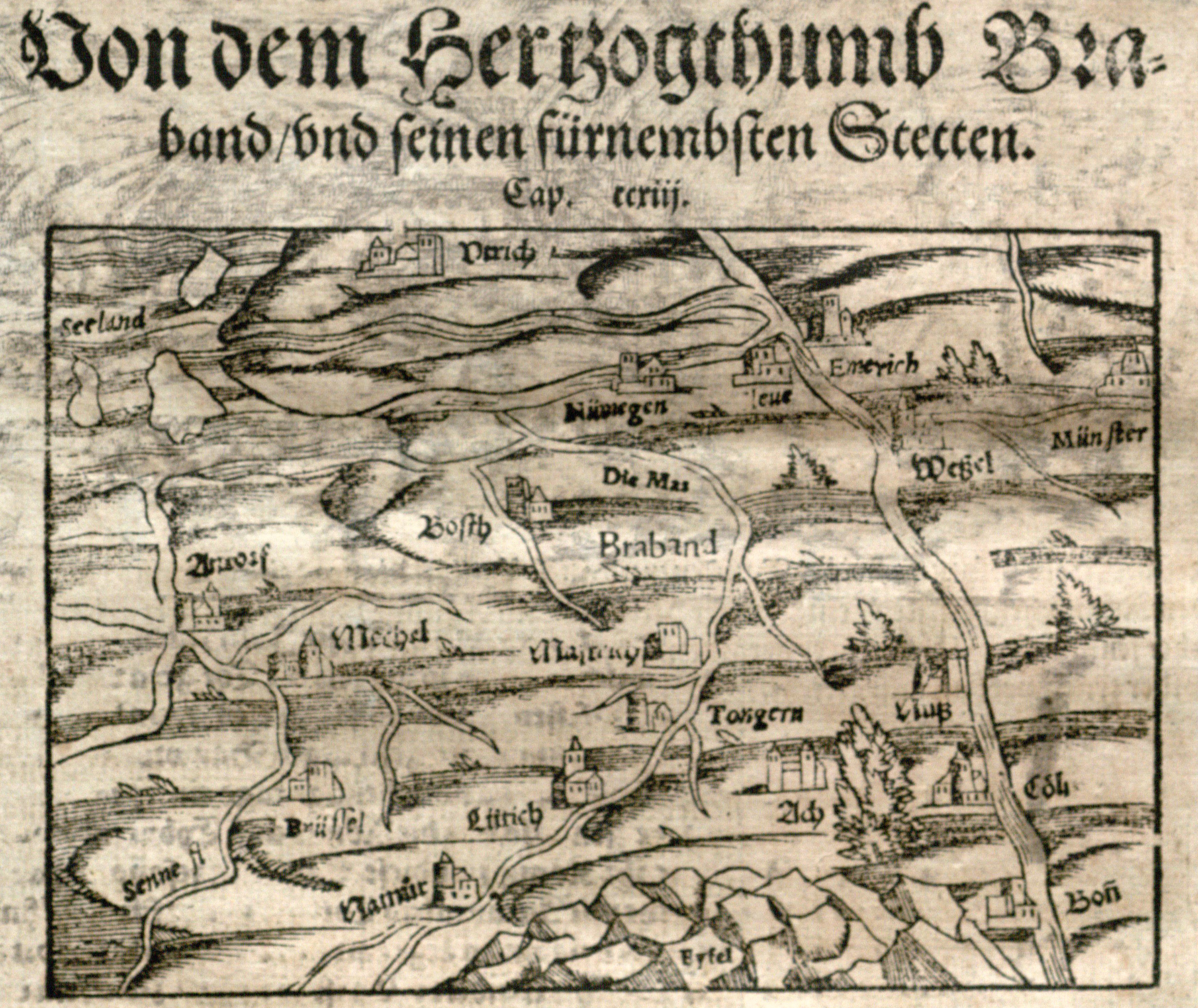
Brabant, woodcut from Münster, Cosmographei (Basle, 1578). UTA Libraries Special Collections
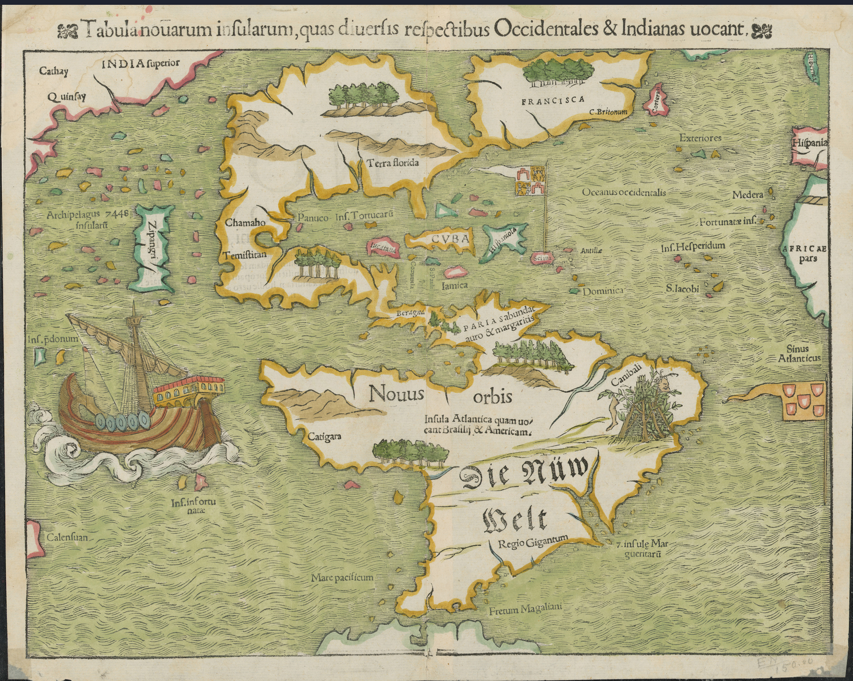
America, woodcut, from Munster, Geographia or Cosmographei (1540). UTA Libraries Special Collections. Gift of Virginia Garrett
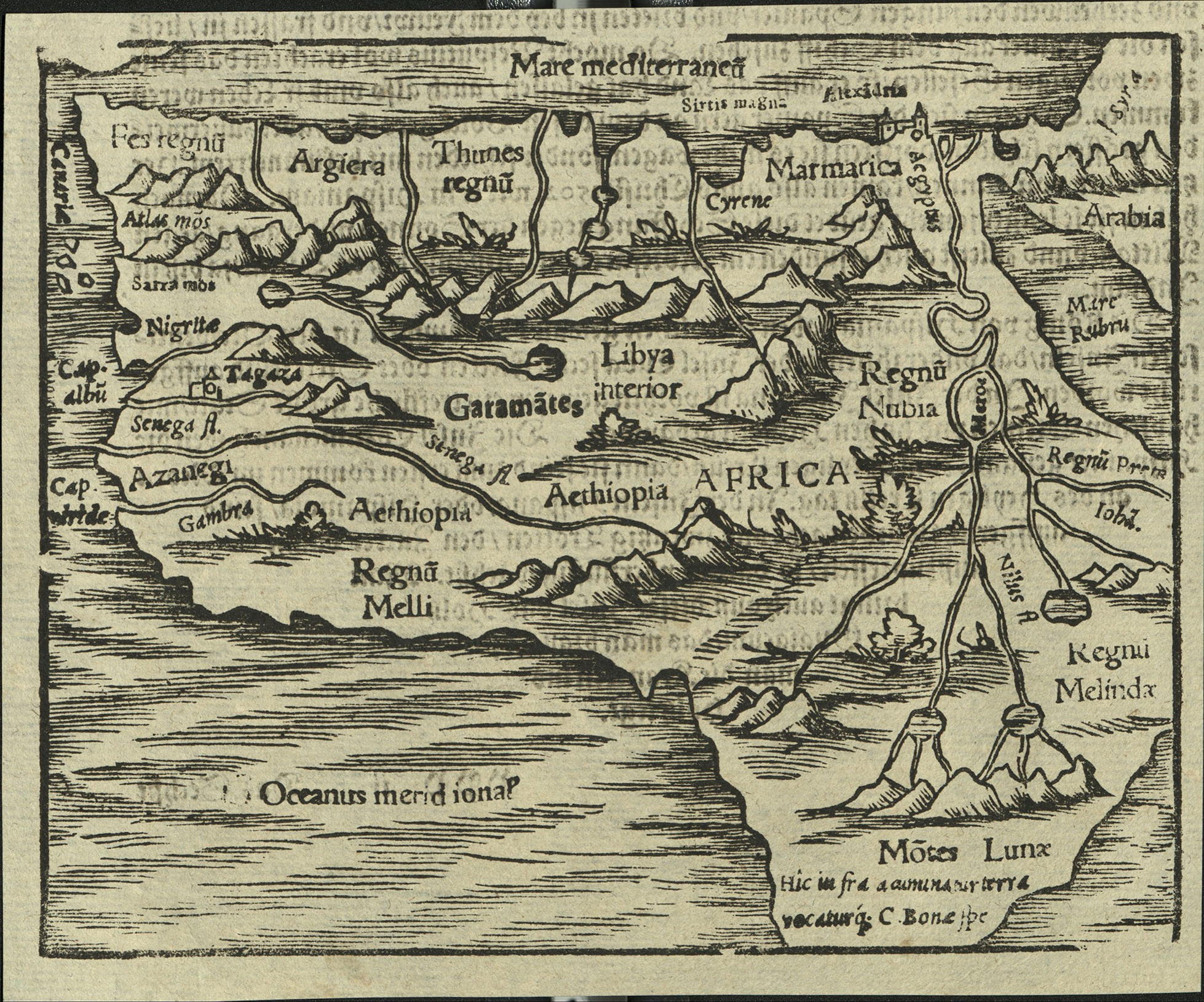
Africa, woodcut from Münster, Cosmographei, 1550. UTA Libraries Special Collections. Gift of Dr. Jack Franke
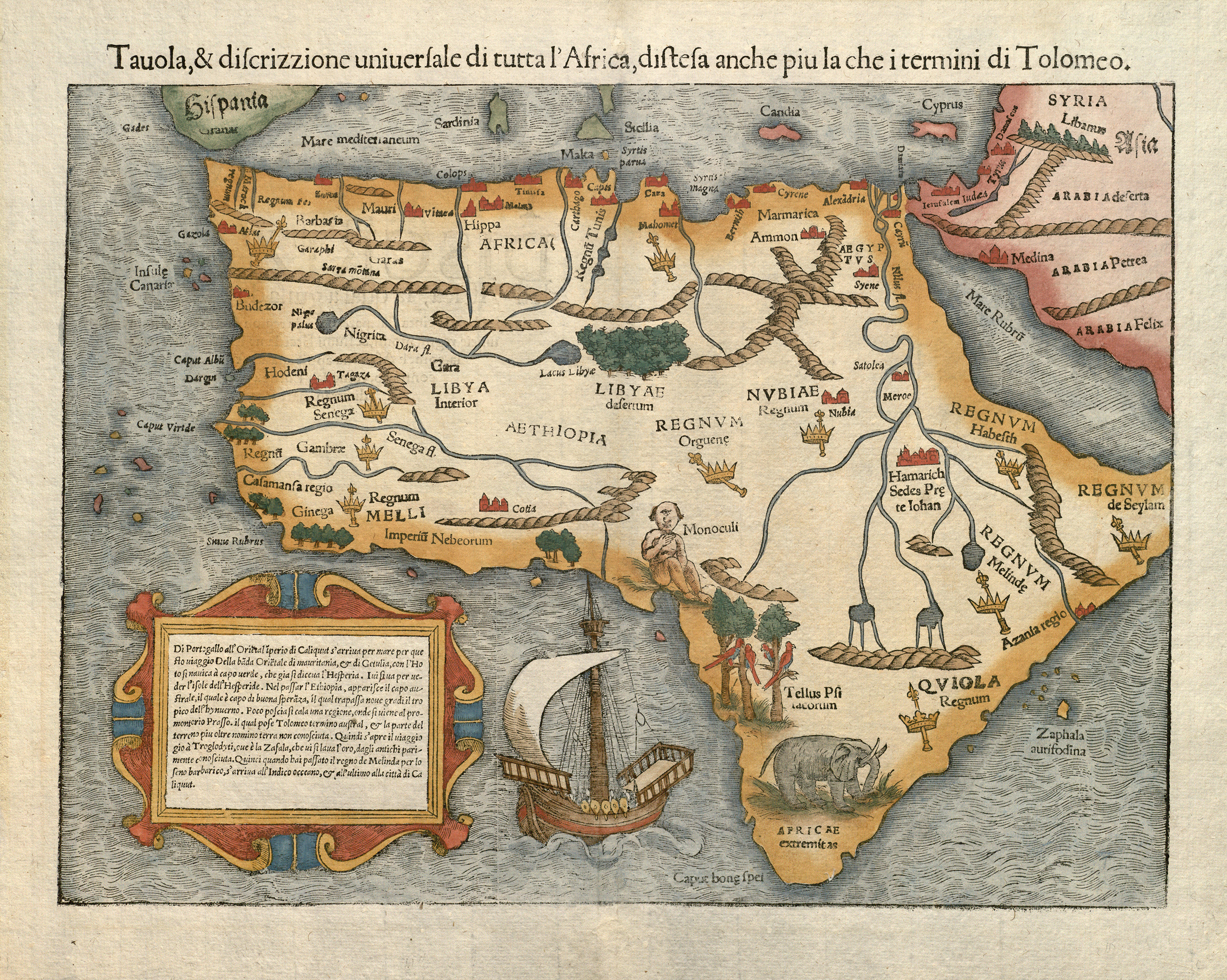
Africa, woodcut from the 1558 Italian edition of Münster's Cosmographia. UTA Libraries Special Collections. Gift of Dr. Jack Franke
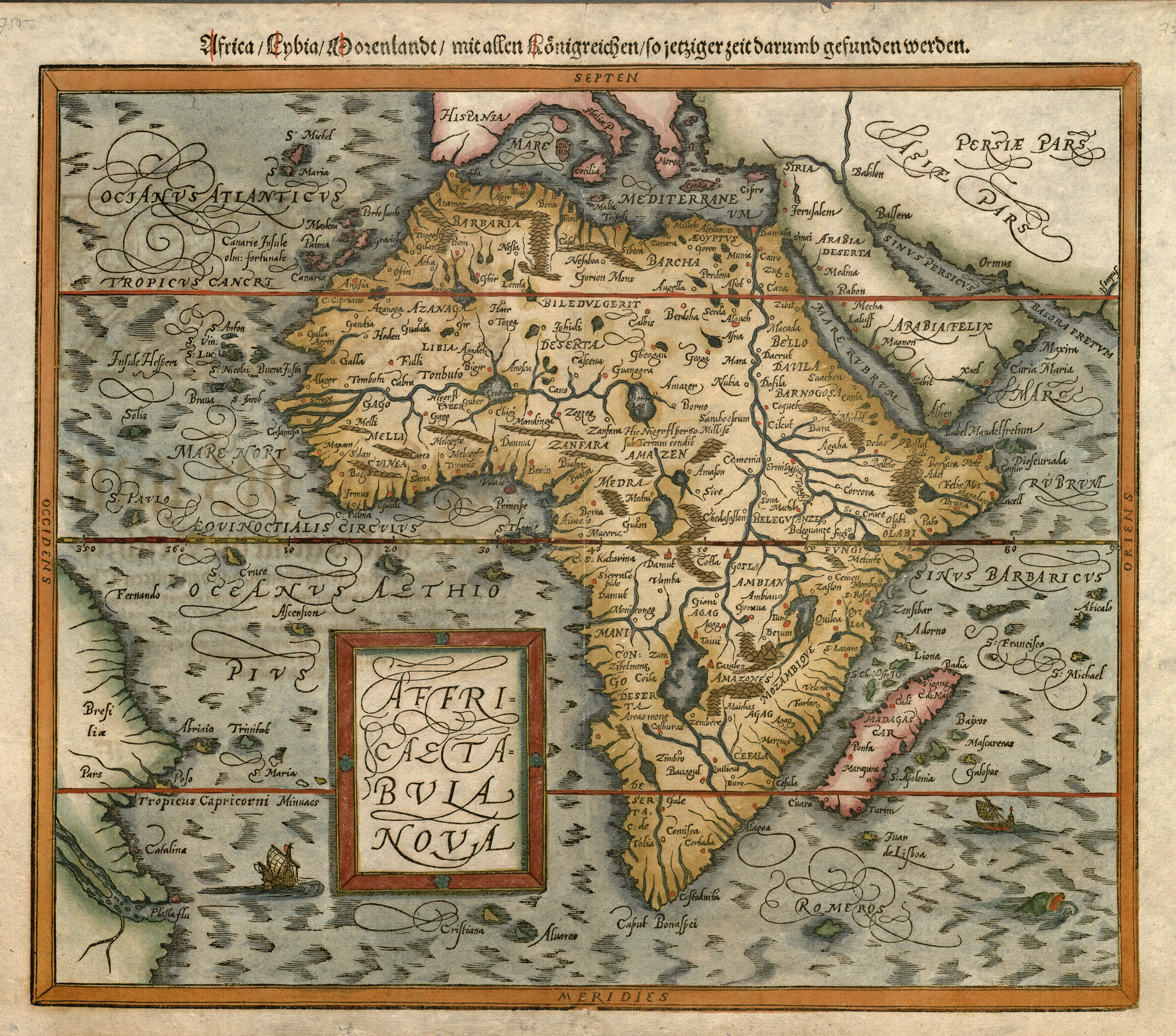
Africa (late edition map), from Münster, Cosmographei (Basle, 1598). UTA Libraries Special Collections. Gift of Dr. Jack Franke
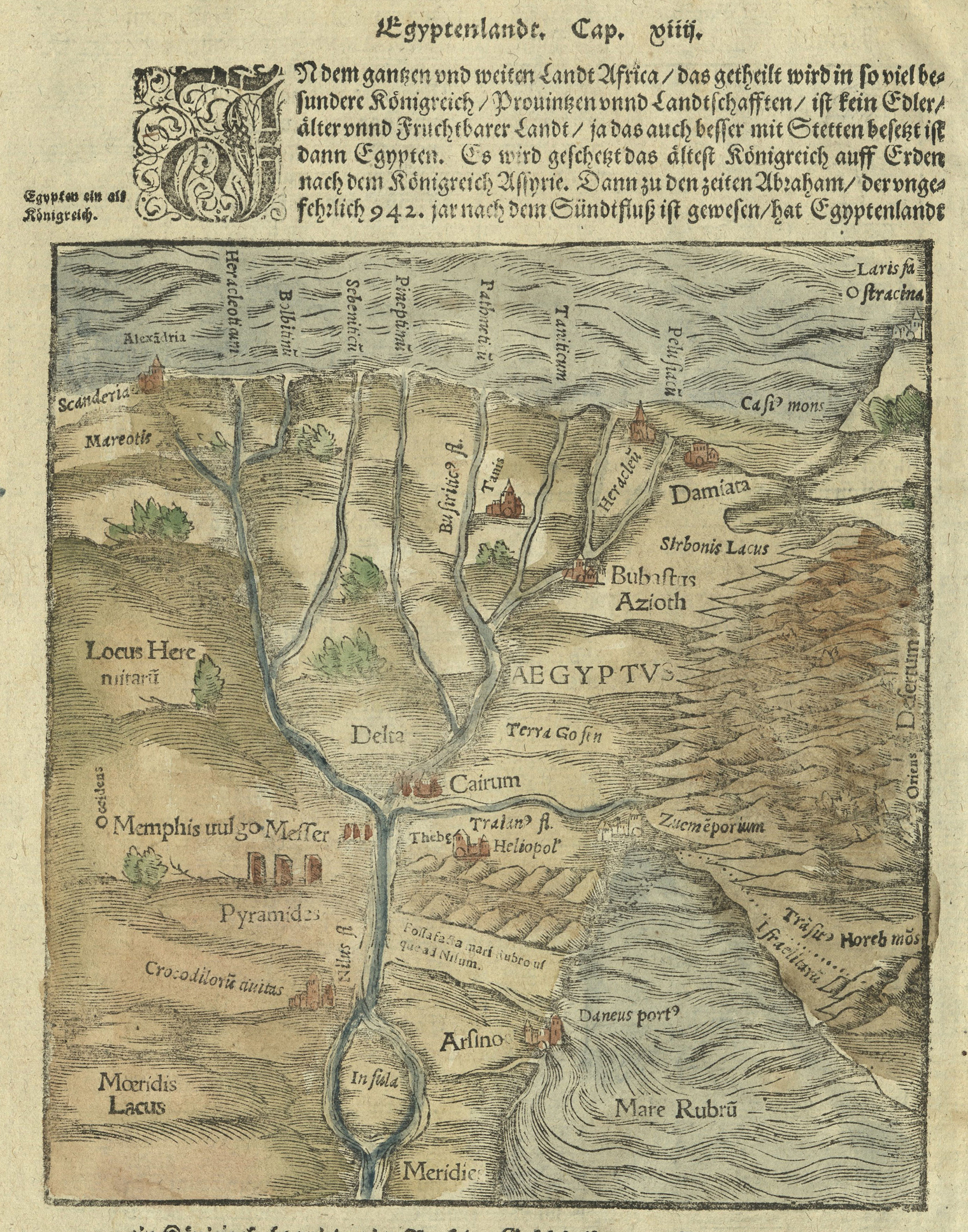
Egypt, woodcut from Münster, Cosmographei (Basle, 1588). UTA Libraries Special Collections, Gift of Dr. Jack Franke
In addition to these there are still other original pages from the Cosmographei featuring woodcuts showing a generic view of a windstorm or earthquake destroying a town, a Swiss city under siege, a flood or deluge, buildings under construction, the abundance and variety of German plants, animals such as deer elk and a boar in the Black Forest, a Christian missionary preaching to the early Germans, German homes, knights jousting, imaginary portraits of Carolus magnus (Charlemagne) and Emperor Frederick the III, and various coats of arms and monograms.
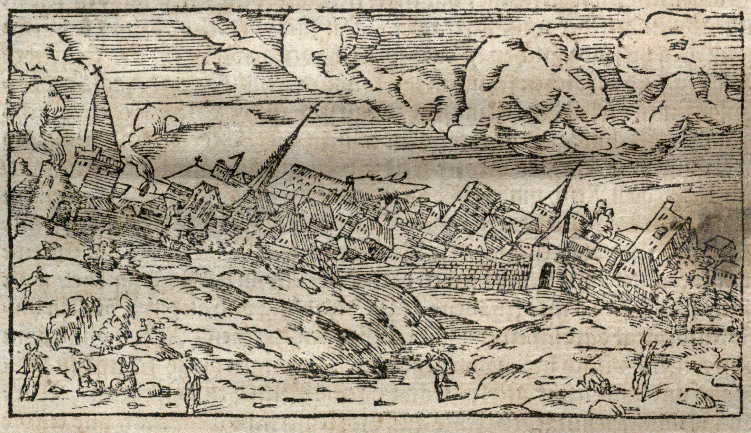
[A City Destroyed by an Earthquake], woodcut, from Münster, Cosmographei (1578). UTA Libraries Special Collections
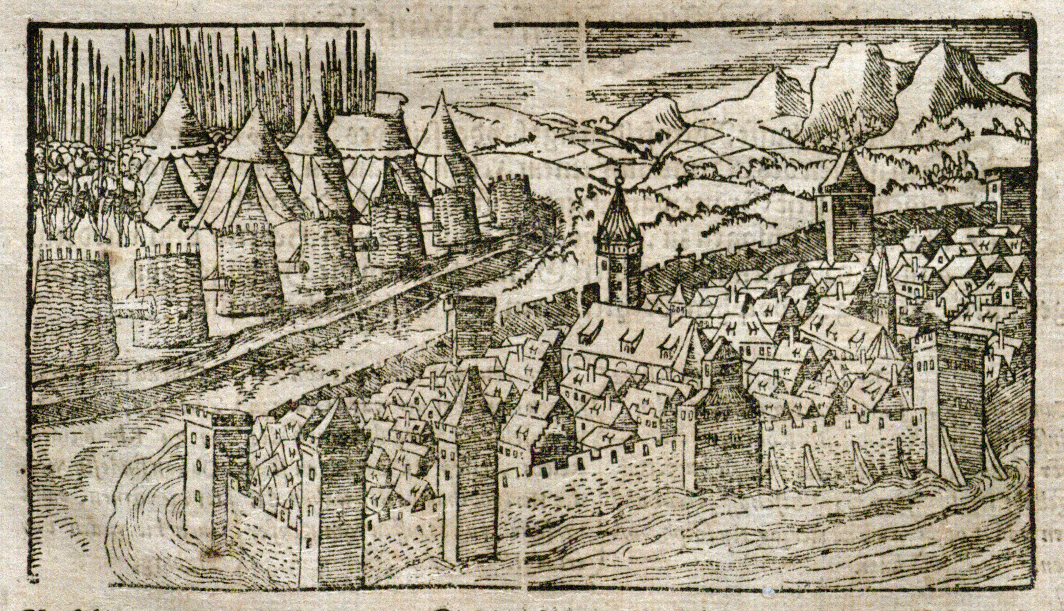
Swiss City Besieged, woodcut from Münster, Cosmographei, 1578. UTA Libraries Special Collections
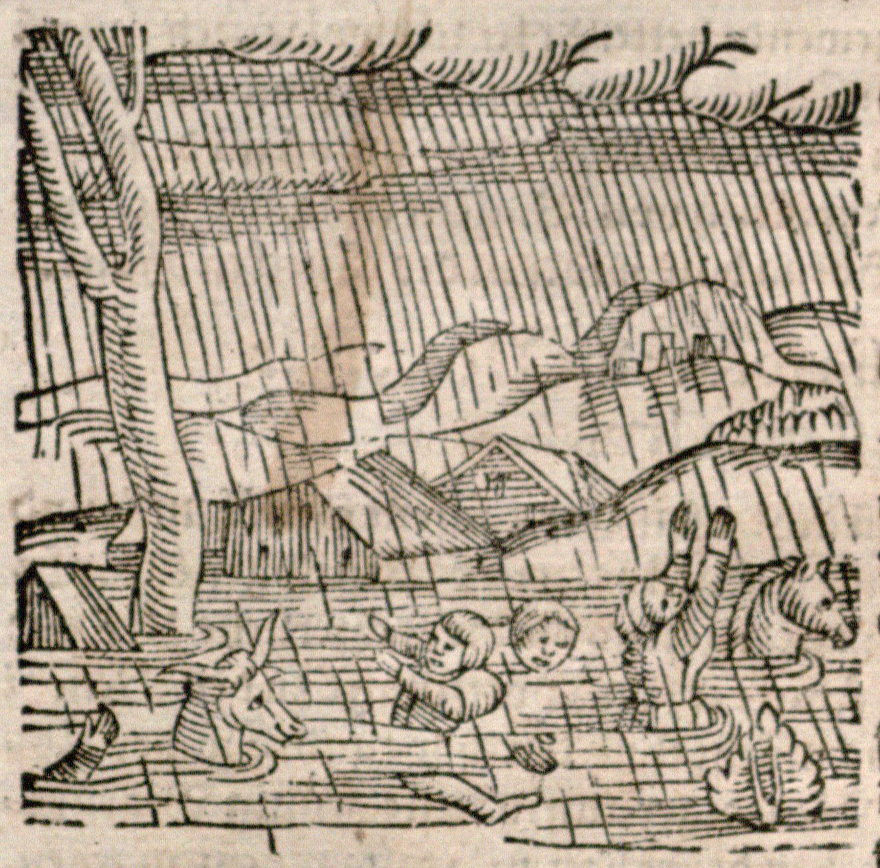
Deluge and Flood, woodcut from Münster, Cosmographei, 1578. UTA Libraries Special Collections
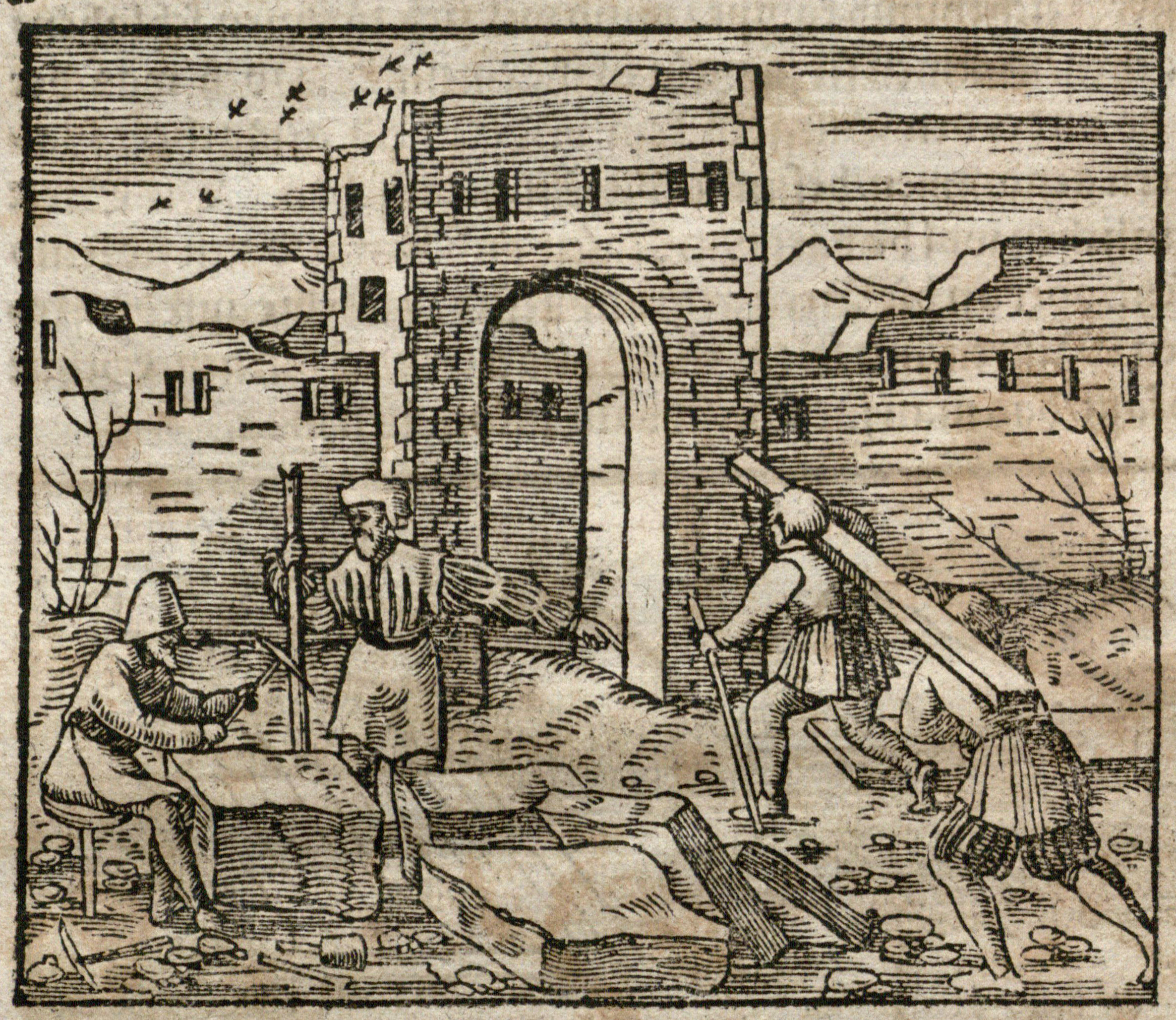
Woodcut showing Construction from Münster's Cosmographei, 1578. UTA Libraries Special Collections
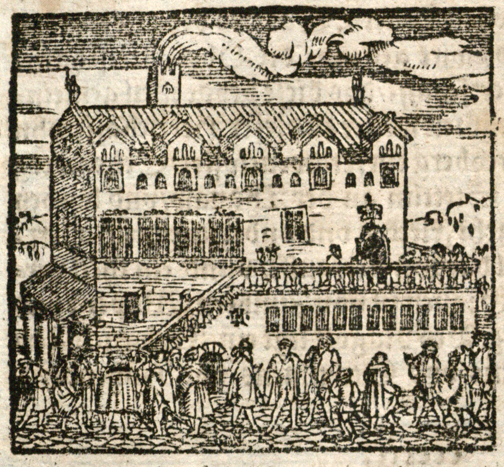
A typical European City Hall of the time, woodcut from Münster, Cosmographei, 1578. UTA Libraries Special Collections
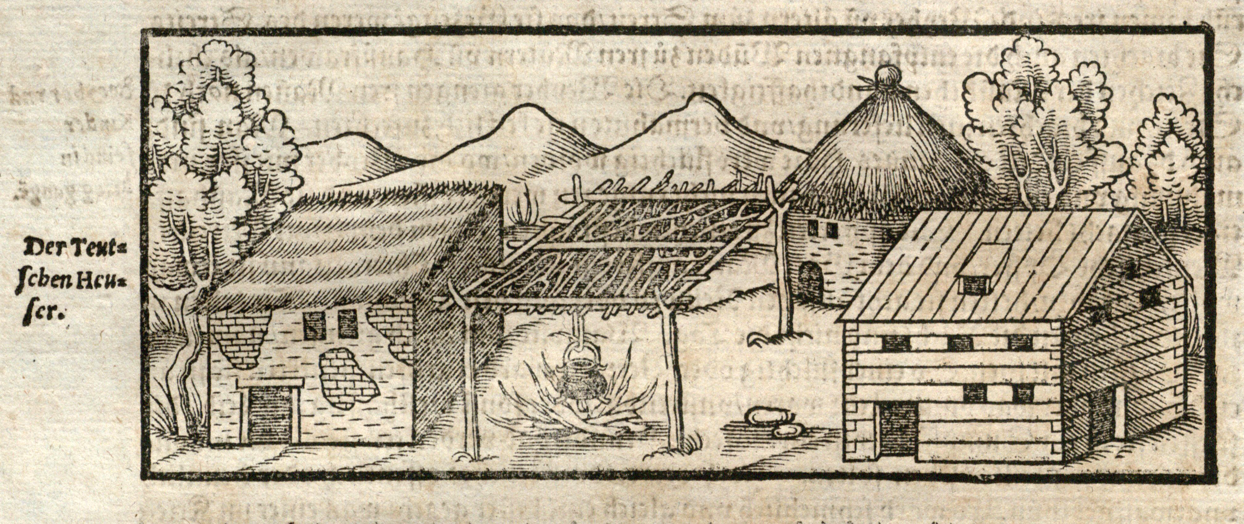
German Peasant Structures, woodcut from Münster, Cosmographei, 1578. UTA Libraries Special Collections
1Ruthardt Oehme, "Introduction," in Sebastian Münster, Cosmographei (Amsterdam: Theatrum Orbis Terrarum Ltd., 1968), pp. v-xxviii. Quote is from Wilhelm Heinrich Riehl, "Sebastian Münster und seine Kosmographie," in Freie Vorträge (Stuttgart, 1873) 1:135-160, as quoted in Oehme's introduction, p. v.
2 Oehme (1968), pp. v-xii; Robert W. Karrow, Jr., Mapmakers of the Sixteenth Century and Their Maps (Chicago: Published for the Newberry Library by Speculum Orbis Press, 1993), pp. 410-434.
3 Oehme (1968), pp. vii-viii.
4 Oehme (1968), pp. xiv-xxi. On Petri, see Tooley’s Biographical Dictionary of Mapmakers, rev. ed., by Josephine French, Valerie Scott, et al. (4 vols.; Tring, England, U.K.: Map Collector Publications and Early World Press, 1999-2004), vol. 3, p. 413.
5 Oehme (1968), pp. xii-xiv, xxi-xxiv; R. A. Skelton, "Introduction" in Braun and Hogenberg, Civitates Orbis Terrarum (Cities of the World) (Cleveland and New York: World Publishing Company, 1966), p. ix.
6 Skelton (1966), pp. x-xi, for a description of similar views for Braun and Hogenberg’s Civitates Orbis Terrarum.
7 On Zorzi, see Karrow (1993), pp. 612-616.
8 See UTA Libraries Special Collections’ reprint of Claudius Ptolemy ed. Sebastian Münster Geographia with an introduction by R.A. Skelton (Amsterdam: Theatrum Orbis Terrarum, Ltd., 1966).
Add new comment