
by Sara Pezzoni

by Sara Pezzoni
The purpose of The Compass Rose is to raise awareness of Special Collections' resources and to foster the use of these resources. The blog series also reports significant new programs, initiatives, and acquisitions of Special Collections.
This is the newest in an ongoing series spotlighting new acquisitions and reproductions of our content. For more on our previous featured material, read our previously published Quarterly Review blogs.
Special Collections is continually acquiring new materials and image reproductions of items from our collections are regularly used in new publications and by media outlets. This post reviews where and how materials from our collections are being used around the world in April, May, and June of 2022.
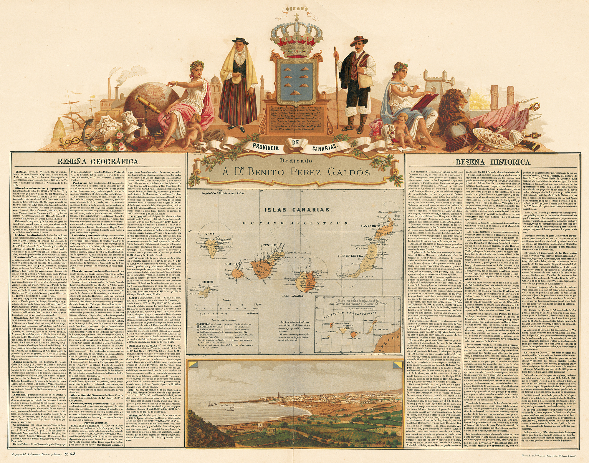
Through the generosity of UTA alumnus Dr. Jack Franke, Special Collections has been actively adding to its collections of African maps. These donations include some wonderful maps of the Canary Islands, located in the Atlantic off the northwest African coast of Morocco. Many may recognize these islands’ important role in world history as the “jumping off” point for European world exploration, but perhaps lesser known is their role in Texas history. Several families of Canary Islanders were among the early Spanish colonists in San Antonio, first arriving there on March 9, 1731. The sheet seen below at left is from an elegant and profusely illustrated Spanish atlas that includes a map of the islands, a map showing their proximity to the African coast, a view of the city of Santa Cruz de Teneriffe, geographical and historical summaries about the islands, and a spectacular cartouche with a Canary Island couple in traditional costumes.
The map below at right shows original etched views which all derive from Portuguese sources and include the two Moroccan cities of Anfa (Casablanca) and Azaamarum (Azammur) as well as the Indian cities of Diu and Goa. With this acquisition, UTA has all the African cities published in this popular and important work, considered the first atlas of city views.
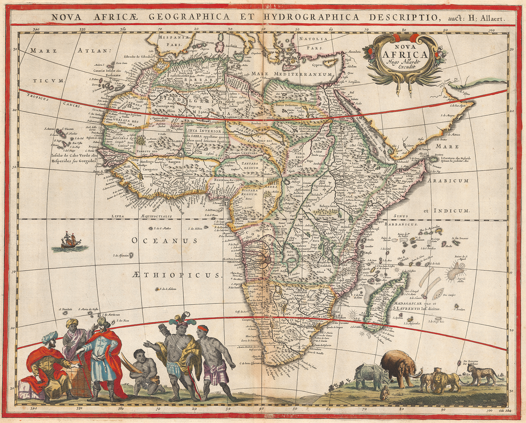
The map image below was produced by map engraver and publisher Hugo Allard or Allardt of Amsterdam (1625-1691) and was based upon a 1660 map of Africa by Frederick de Wit, also owned by UTA. However, according to an inscription at lower right, Allard himself was not the engraver, but instead another Dutch engraver, Jan van de Velde. UTA also owns an original example of Allard’s rare map of Guinea. The more unique features of the map are the costumed figures at left and the animals at right – yet they too reportedly derive from a Dutch wall map from ca. 1665.
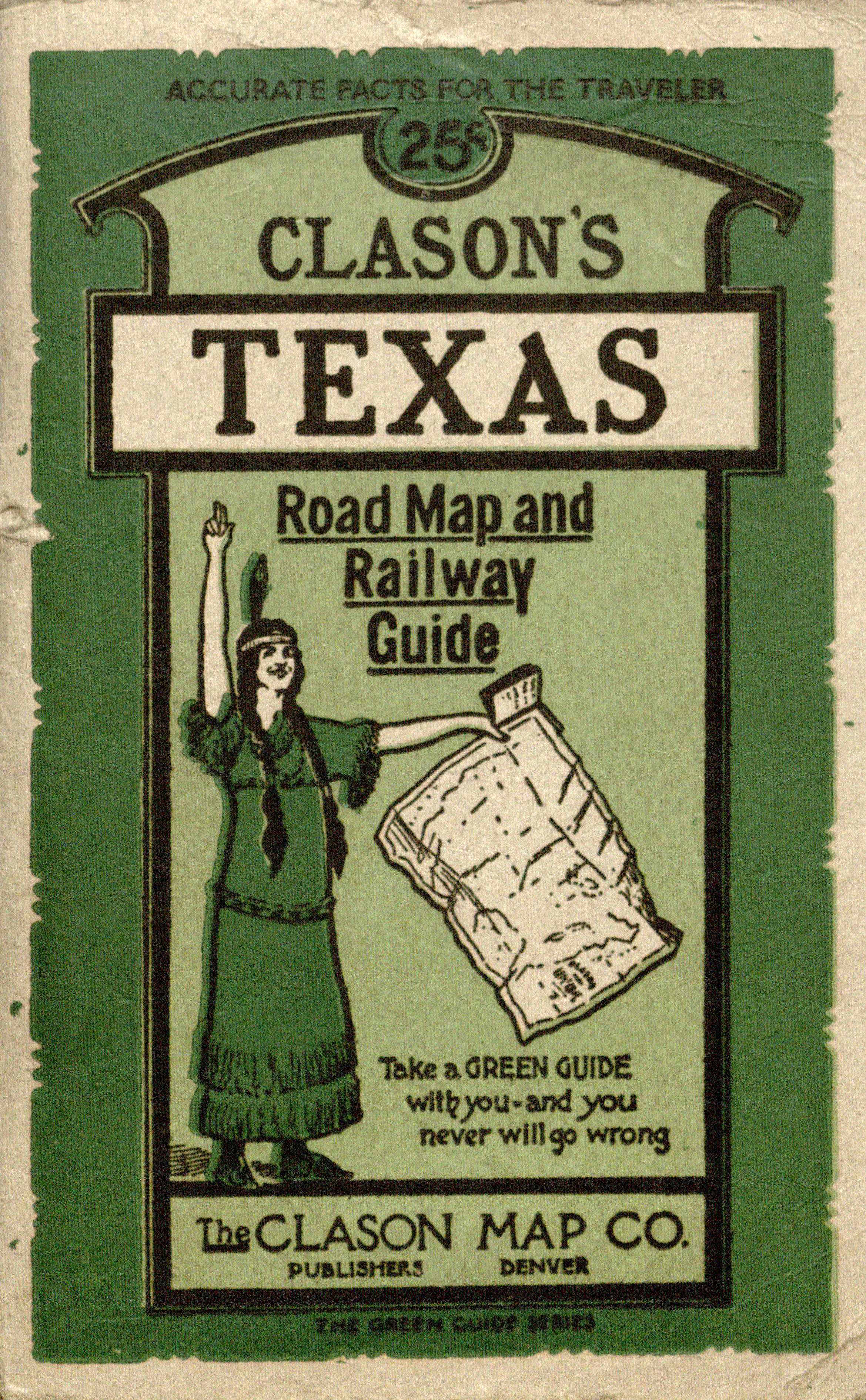
Adding to our collection of Clason’s Green Guides of Texas, we have acquired a new Clason's Guide, published in 1920 (below, left). This early automobile map of Texas was printed in three colors, unfolds to 21-½ x 23-¼ inches, and shows county lines and county seats, and differentiates between Railroads and Trunk Line Railroads, “Automobile Roads” and “Main Auto Roads.” The key also shows electric railways and steamship lines. The map includes a guide in pamphlet form that contains geographical and statistical information, a map of San Antonio, and a 1920 index of cities and towns and “Texas Automobile Routes” with “Pole Markings.”
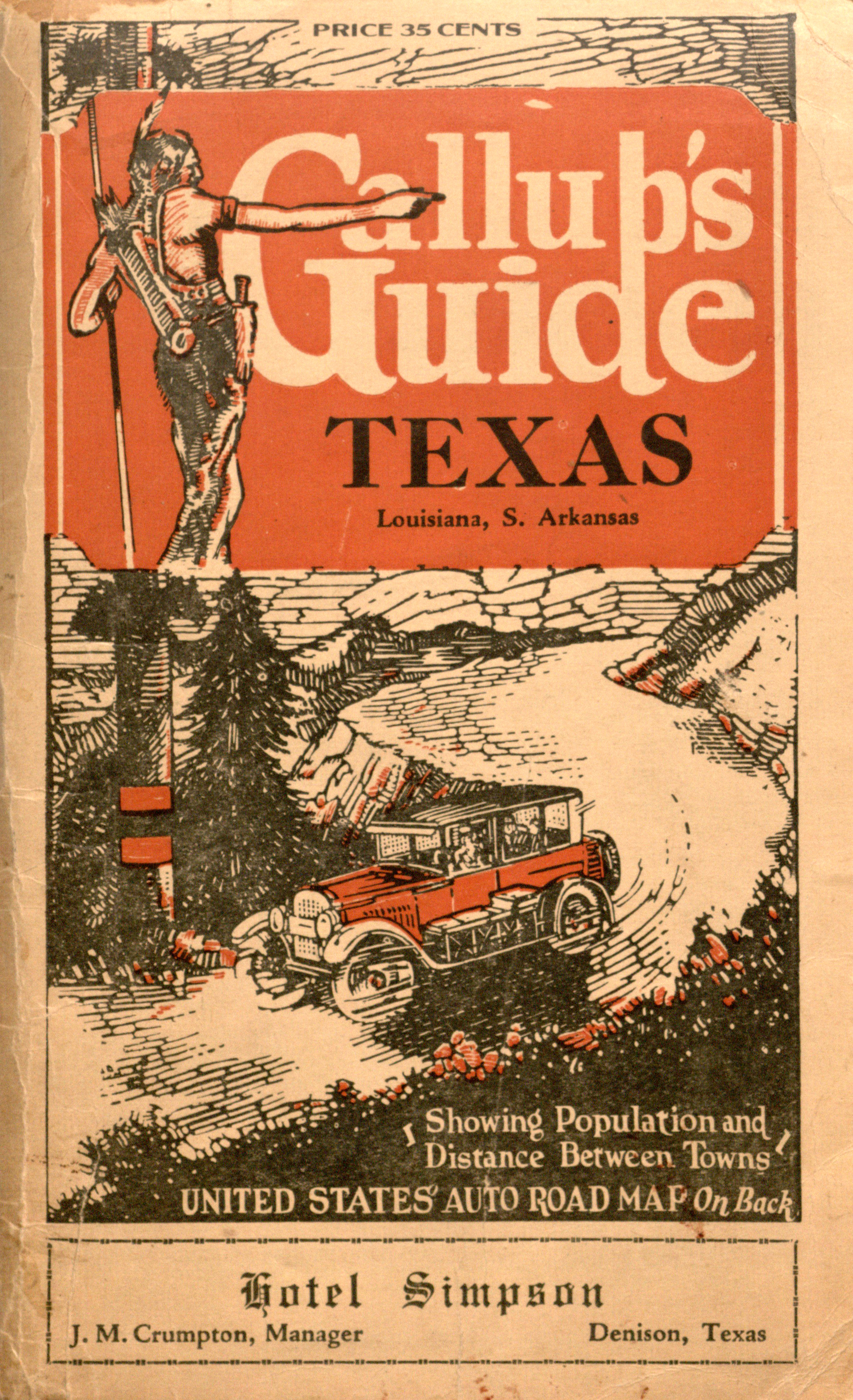
We have also acquired this Gallup’s Guide: Texas, Louisiana, Southern Arkansas (below, right), issued by the Hotel Simpson in Denison, Texas (ca. 1920s). In addition to the colorful front cover, there is a photolithograph on the back cover of the Hotel Simpson touted as “the Star of the Lone Star State” and “Modern” and “Fireproof.” The map itself unfolds to 26-¼ x 32 inches and shows eastern and central Texas, all of Louisiana, and parts of southern Arkansas and Oklahoma. An extensive key at the bottom of the map details “Marked Highways” and “Connecting Roads” which are differentiated as “Paved”, “Improved”, “Earth”, and “Under Construction.” Other symbols denote “Tourist Camps”, “Summer Resorts”, “Caves,” and “State Parks” among other items of interest. There are also explanations for road signs and highway markers. A less detailed “Gallup’s Auto Route and Commercial Highway Map of the United States” is on the back of the map sheet.
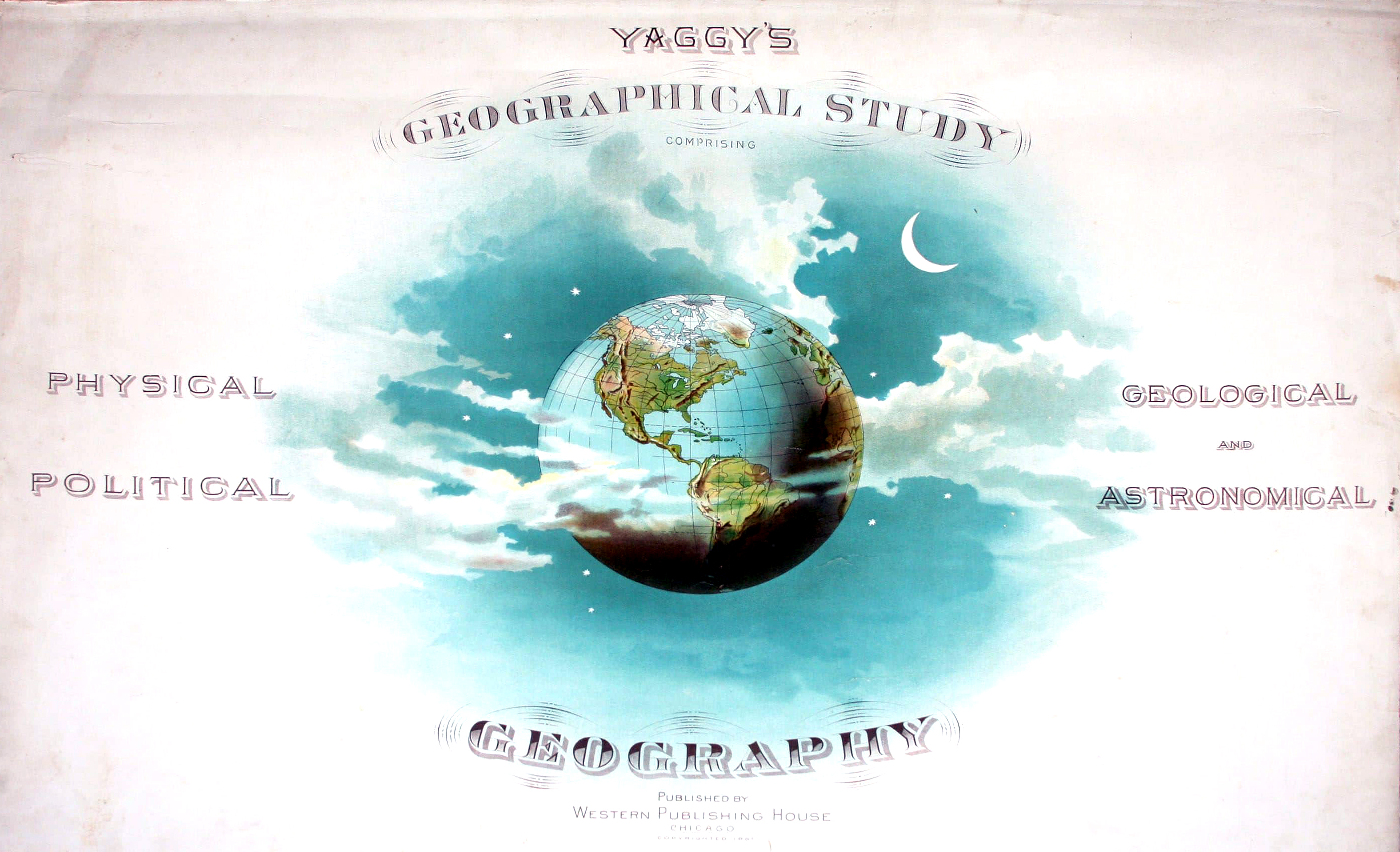
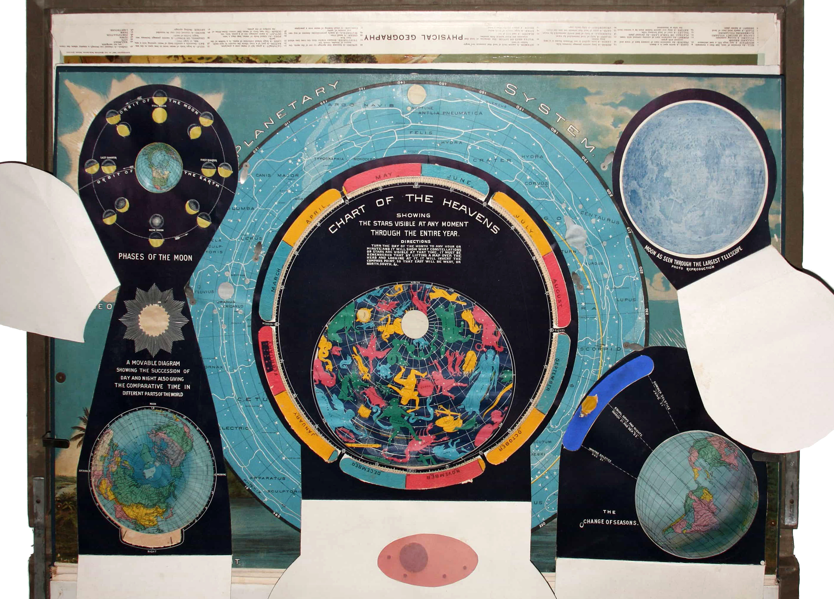
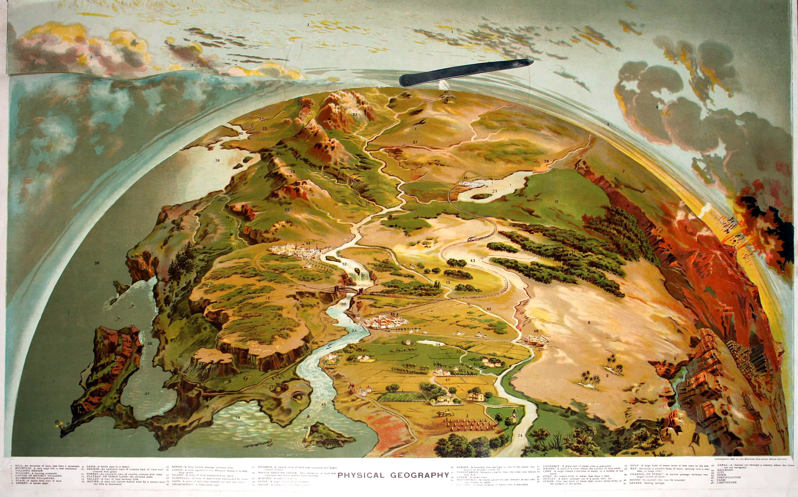
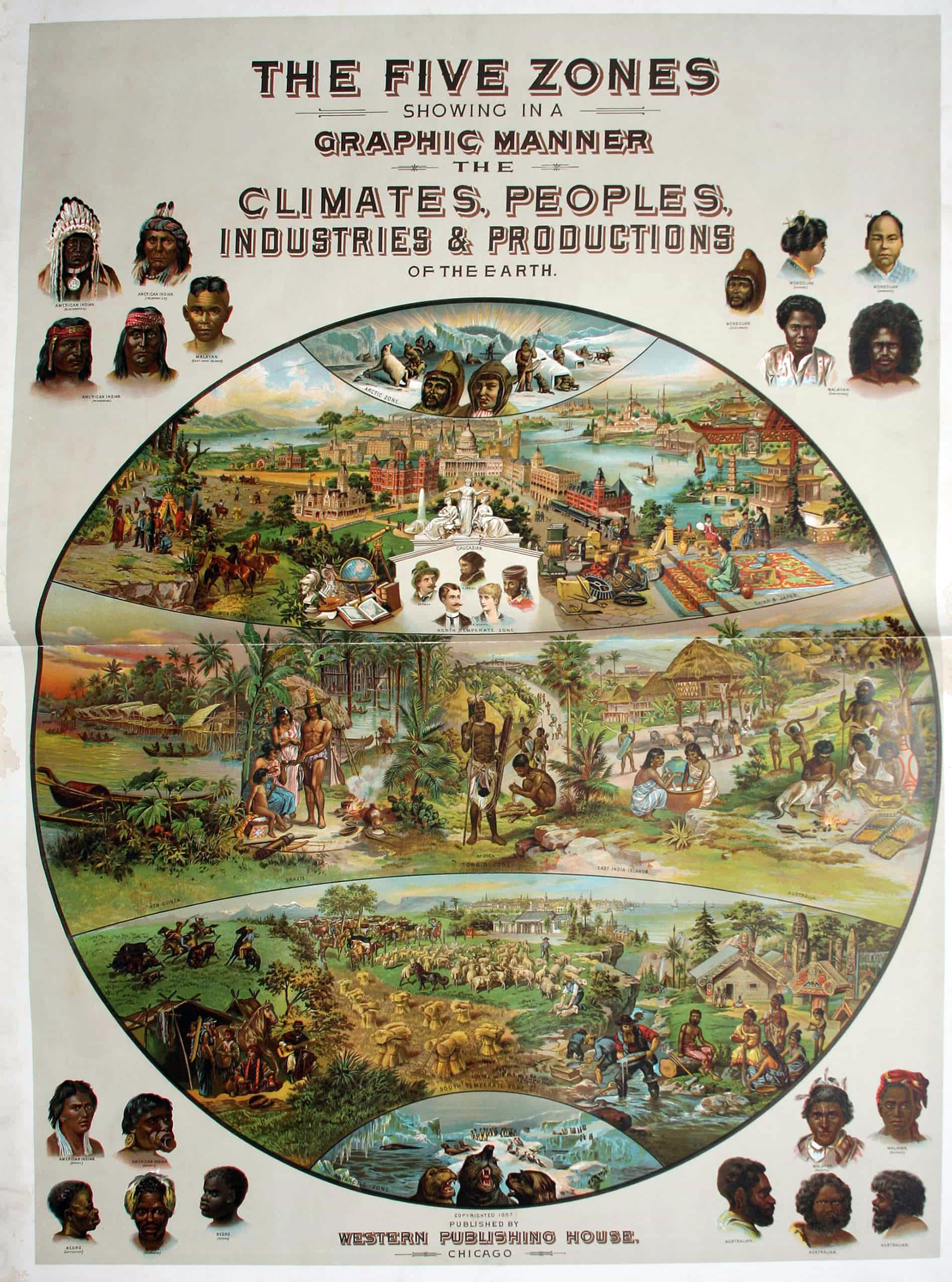
We have acquired Yaggy's Geographical Study Comprising Physical Political Geological and Astronomical Geography (1887) by Levi Walter Yaggy and Henry Gannett. The late 19th-century teaching atlas includes 14 chromolithograph plates and maps, as well as a relief map of North America. Various metal clamps and props enable display of these plates and maps.
The chromolithograph title page (measuring 23.5”h x 35.5”w) bears an illustration of the earth, moon, and stars. Included inside is a chromolithograph chart, titled Planetary System, bearing a central image of a star chart on a north polar projection, with cut outs for the planets and their major moons, each filled with colored linen and designed to be viewed with a light shining through the verso. The corners are adorned with images of the Moon, a solar eclipse, a meteor shower and the Milky Way. Also included in the atlas are double-page maps representing the Eastern and Western Hemisphere, as well as a map of Europe, Asia, Africa, South America, and North America. Each continental map depicts major topographic features, political boundaries, and cities. There is another chromolithograph chart included, titled The Five Zones Showing in a Graphic Manner the Climates, Peoples, Industries & Productions of the Earth, bearing a central image of a schematic map of the earth’s five “zones,” with each zone bearing illustrations reflecting its characteristic climate, population, and economic activities. The corners bear 20 illustrations of people from various races and nationalities. Another chromolithograph chart included, titled Physical Geography, depicts a cross-section of the earth’s geological strata, along with a chart depicting geological and zoological aspects of “The Pre-Adamite Earth.”
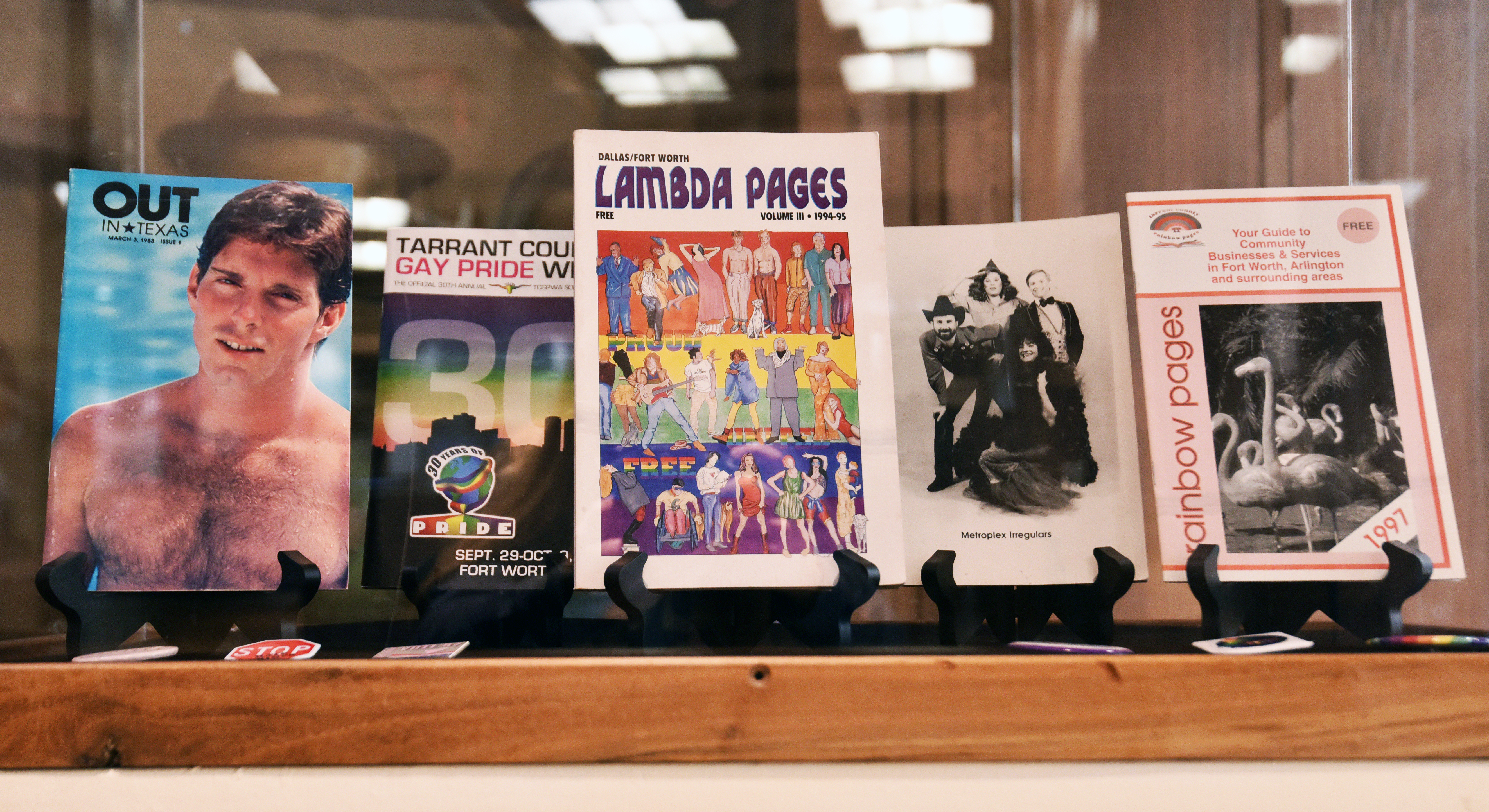
This quarter, we acquired our first donation to the Tarrant County LGBTQ+ Collection! This is is a new and growing collection meant to help collect and preserve the important stories of the local and University LGBTQ+ community. The first donation consisted of a variety of different LGBTQ+ publications from Fort Worth and Texas. These materials were donated by Todd Camp, founder of the Fort Worth Gay History Archives. Select publications were featured in a mini-exhibit celebrating Pride Month at Special Collections.
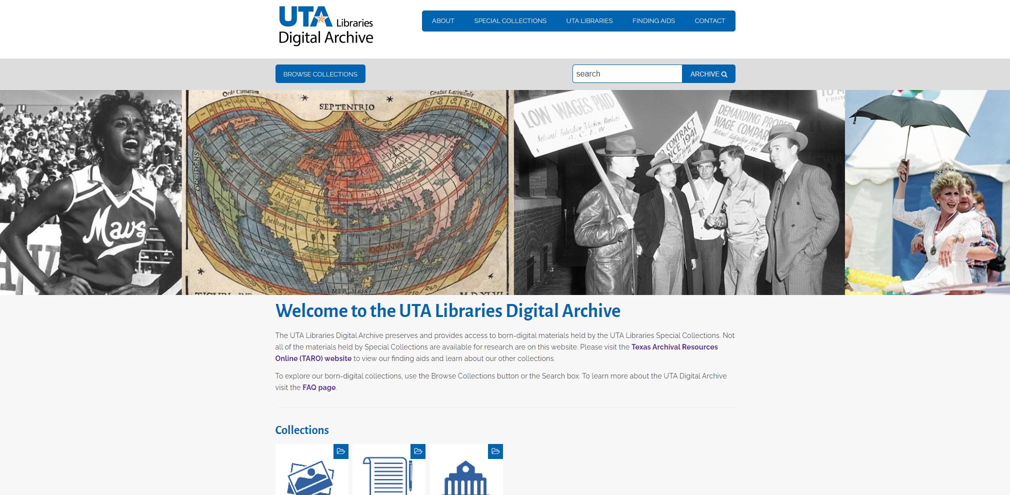
The newly launched UTA Libraries Digital Archive provides access to born-digital and select digitized materials held by Special Collections. Not only does the Digital Archive provide access to born-digital materials, it also provides long-term preservation of the materials it holds. The UTA Digital Archive is powered by Preservica, which is a digital preservation system that integrates different tools and workflows to store, organize, and maintain integrity of digital materials. Similar to acid free boxes and temperature controlled storage for physical records, the Digital Archive allows us to ensure these records are accessible for future researchers. We have added two collections to the Digital Archive this quarter:
Materials found within Special Collections’ holdings have been used across a wide variety of outlets, including (but not limited to) features in local news stories, on television shows, printed in publications, and used in public exhibitions. Below are some examples of where and how our materials have been used this quarter.
The Fort Worth Star-Telegram collection, which came in increments to UTA Libraries from 1984 to 1999, is often used in a variety of news articles and columns published by the original donor, the Fort Worth Star-Telegram. This quarter, the Star-Telegram used photographs from the collection for 20 stories:
Other local news outlets published the following stories using our collection materials:
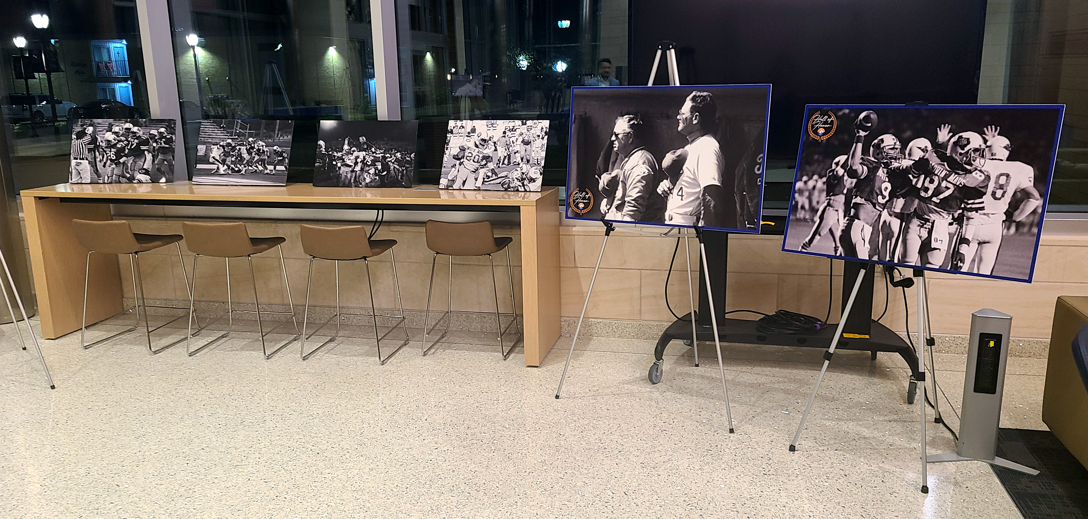
In coordination with the UTA Athletics Department and UTA Football alumni, Special Collections digitized 102 photographs and 6 motion films of the UTA Football Team during the 1981 season. The team was a recipient of the 2022 Hall of Honor award from the UTA Athletics Department. A select number of these digitized photos and video clips were featured in the banquet event's video presentation and several poster-size prints were featured in the lobby for the event, which was held on April 23, 2022.
Visit The Compass Rose in September for our next quarterly blog review!
![Georg Braun & Frans Hogenberg, Anfa… [Casablanca, Morocco] / Azaamarum… [Azemmour or Azammur, Morocco] /Diu. [western India] / [India] etching on paper, from Civitates Orbis Terrarum](https://libraries.uta.edu/sites/default/files/2022-06/20157073a.jpg)


Add new comment